Completed Transportation and Public Space Projects
Creating resilient public spaces that connect Calgarians and bring communities together Completed Transportation and Public Space Projects
Our city is designed to bring Calgarians together so communities and businesses can thrive.
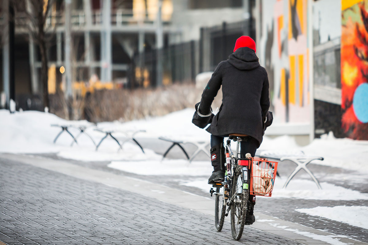
Our sidewalks, pathways, trails and protected on-street bikeways connect communities and provide Calgarians with safe and accessible year-round opportunities to walk, cycle, run, ride, and use mobility devices.
Our focus is on providing inclusive, equitable, safe, accessible and reliable sidewalks and pathways to ensure walking and wheeling are viable and attractive options for all Calgarians.
From traffic-calming measures to updated street designs and transportation improvements, we strive to ensure our streets, pathways and sidewalks are safe and welcoming, that they support a variety of travel choices, support great destinations, and promote fun and healthy lifestyles.
Below are examples of recently completed transportation and public space projects and their outcomes, grouped by project size and city quadrant.
Small-scale projects: Quick fixes
These are generally low-cost improvements that can be implemented relatively fast in neighborhoods to address immediate needs.
They are specifically focused on a street corner, intersection, pathway or street and are not part of larger community projects.
Cost for small-scale projects: Less than $75,000 each.
Northeast
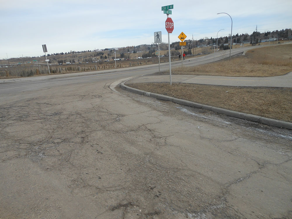
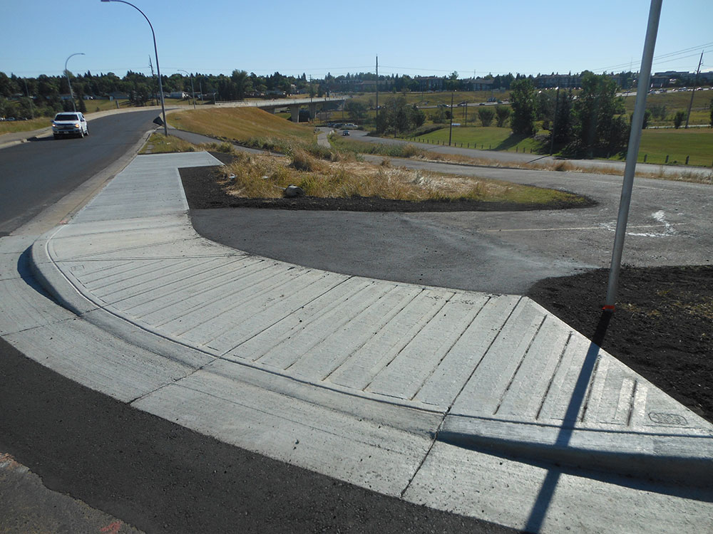
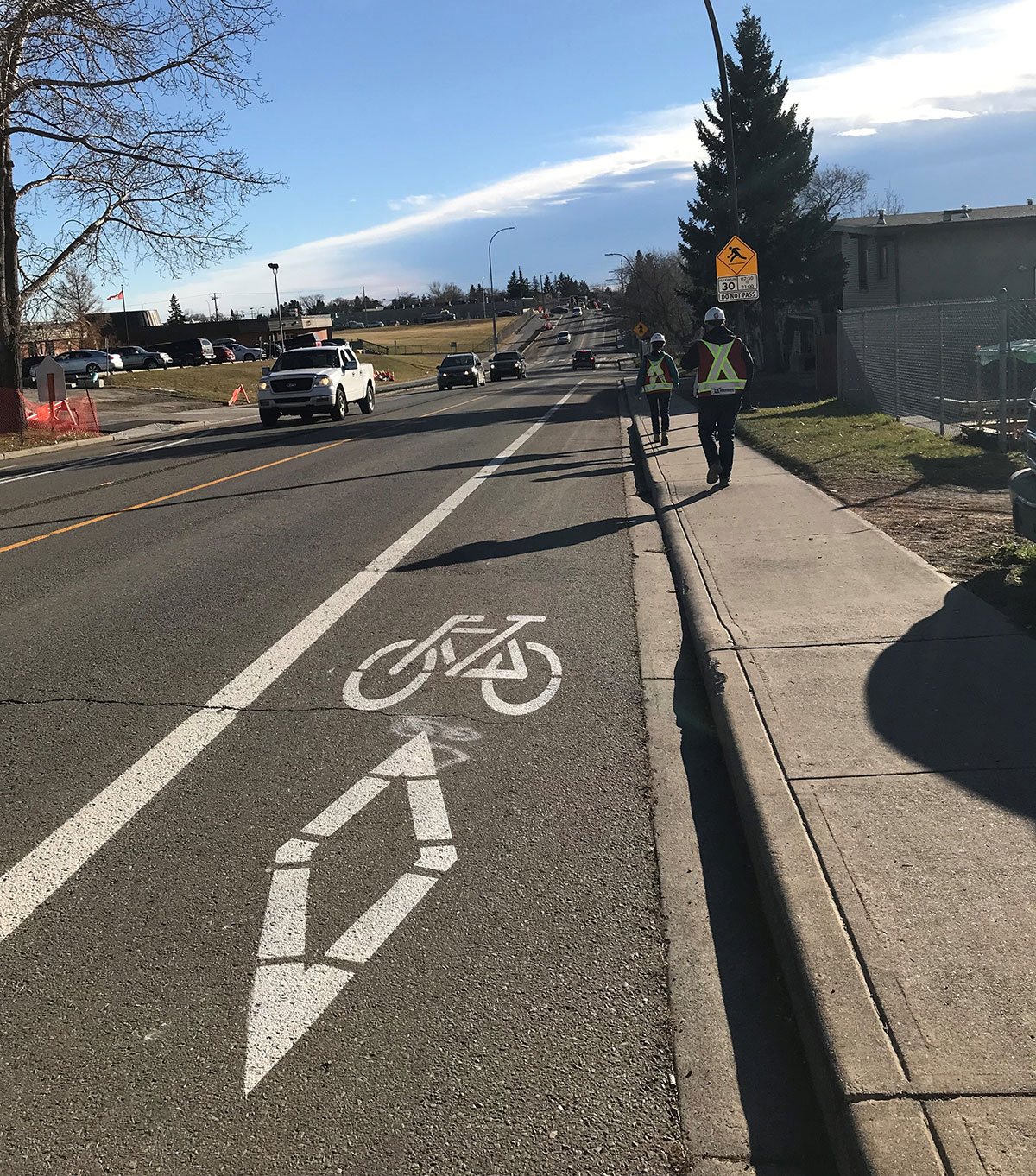
8 Avenue & 13A Street N.E.
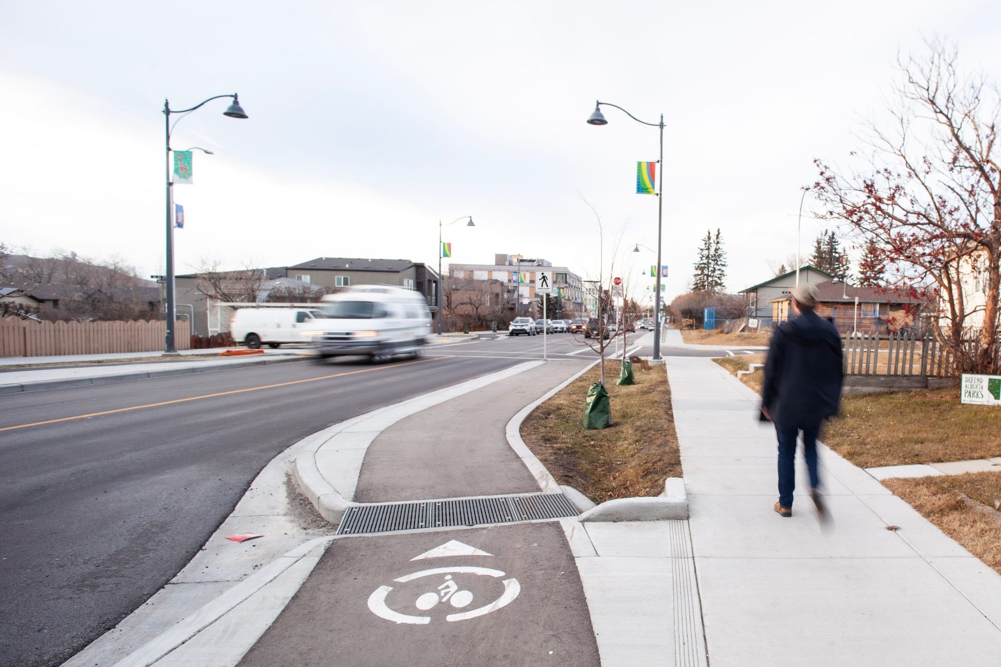
In August 2020, a new multi-use pathway and accessibility ramp were installed on the SE corner of 8 Avenue and 13A Street N.E.
This helped improve accessibility and safety by allowing pathway users to safely join the existing on-street bike lanes crossing the 8 Avenue Bridge in the east bound direction.
The City also added a connecting sidewalk on the south side and installed a new bus pad for transit users.
Before
After
28 Avenue & 11 Street N.E.
In August 2020, a sidewalk was installed in Vista Heights on the south side of 11 Street and 28 Avenue N.E.
By adding in the missing side walk connection, we made it safer and more convenient for pedestrians to connect to the pedestrian bridge and access the businesses along 32 Avenue N.E., as well as the many cultural associations in the area (Austrian, Polish and Croatian cultural associations).
Before
After
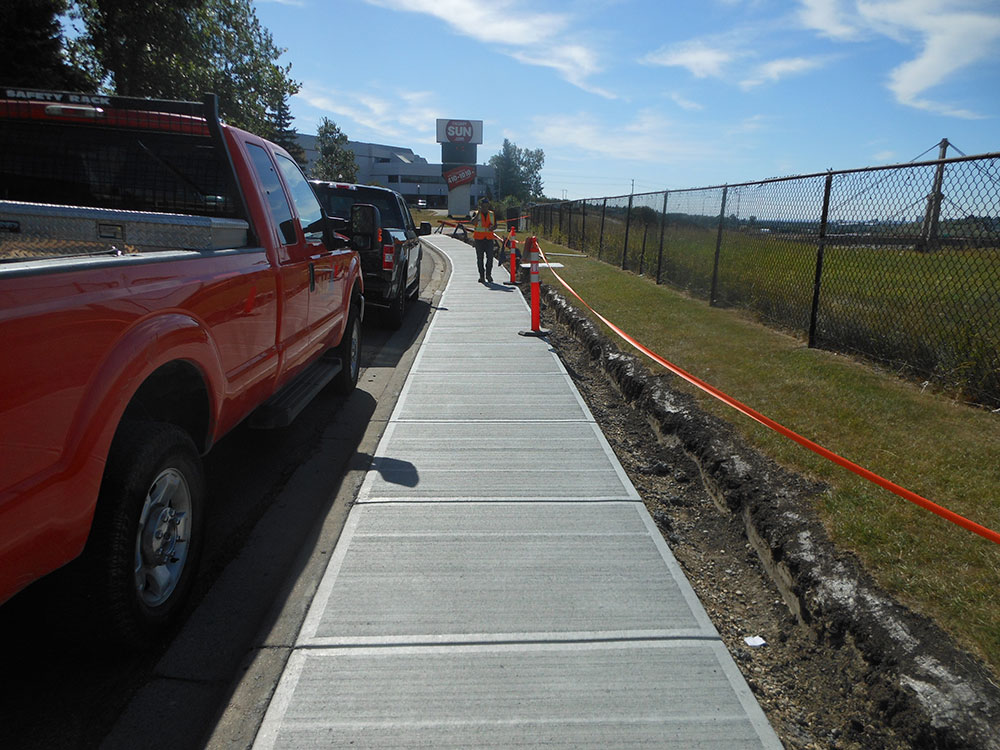
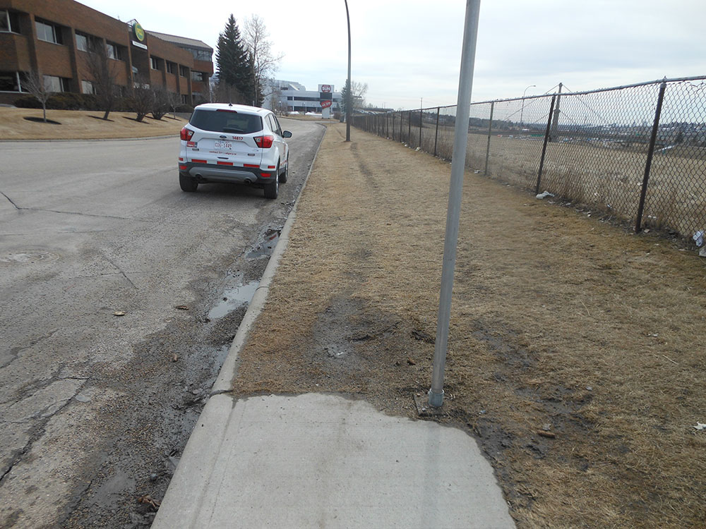
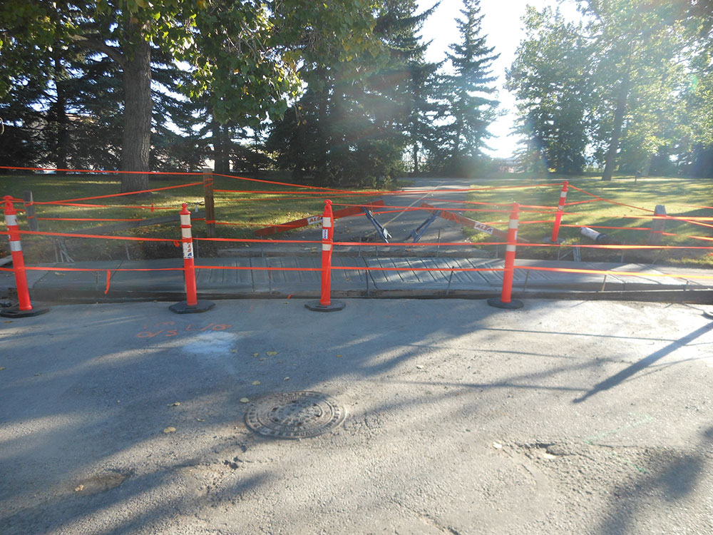
1020 Robert Road N.E.
In August 2020, a new accessibility ramp was installed and the bollard was removed. This helped improve safety and accessibility for Calgarians who use the pathway and connected the on-street bike network to the Nose Creek Regional Pathway.
Before
After
Northwest
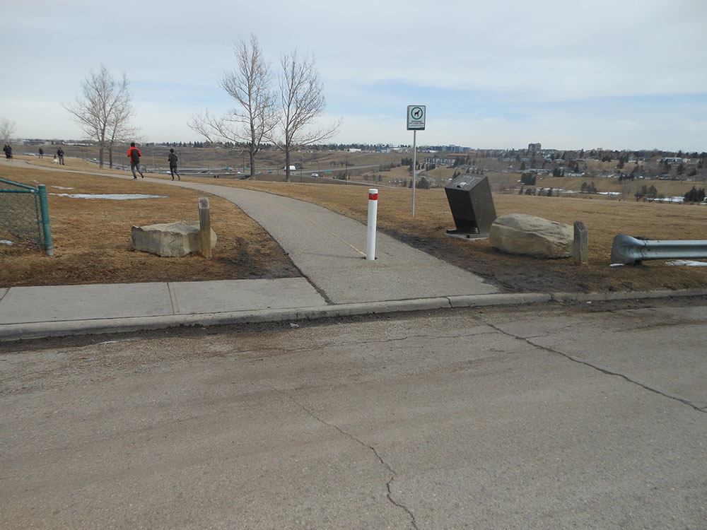
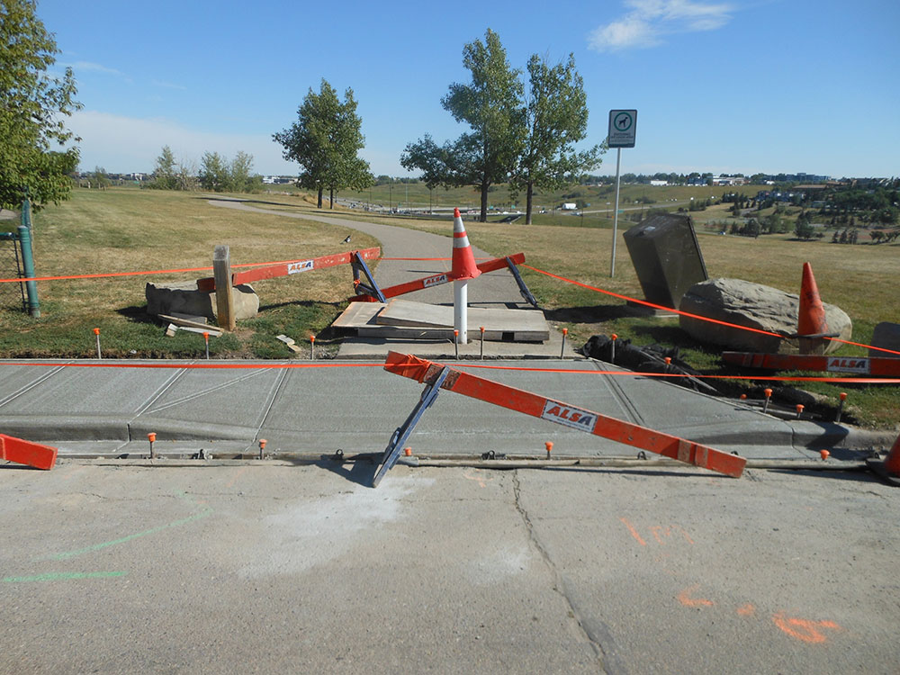
13 Avenue & 16A Street N.W.
In September 2020, we removed a bollard, widened the existing pathway and installed an accessibility ramp on the east side.
This helped decrease pathway congestion and improved accessibility for cyclists and pedestrians in the area.
Before
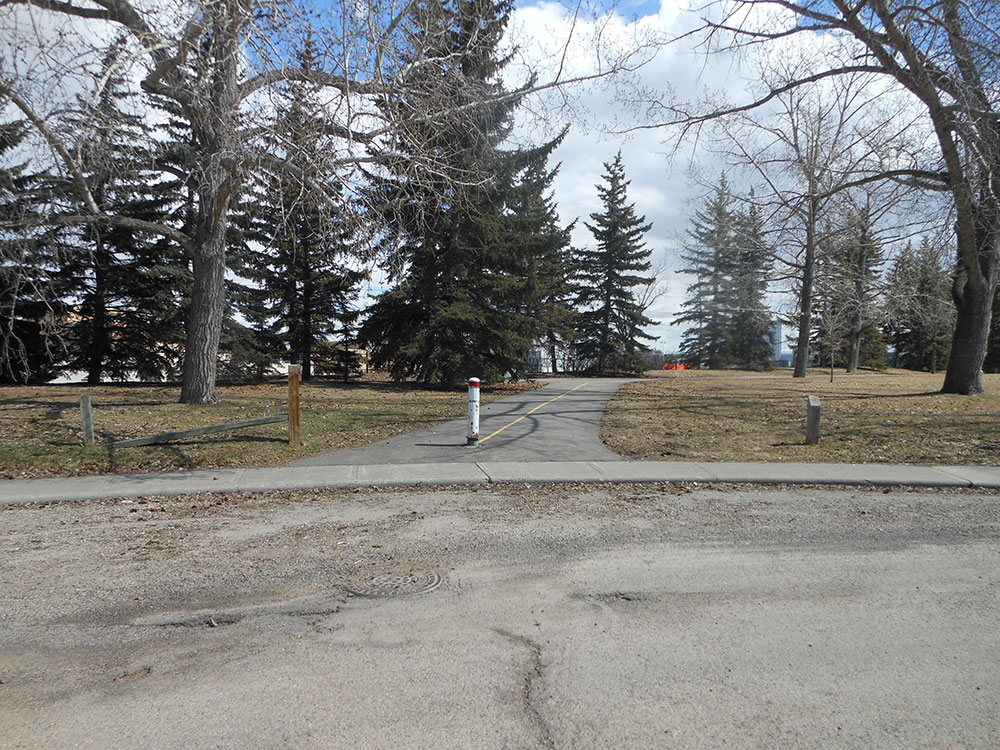
After
Southeast
2 Avenue & 27 Street S.E.
In September 2020, we installed a new sidewalk and accessibility ramp on 2 Avenue and 27 Street S.E. to help address the lack of connectivity and create an accessible link from the Franklin LRT station to nearby businesses.
Before
After
Southwest
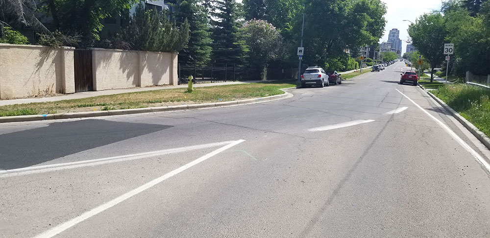
1242 Lansdowne Avenue S.W.
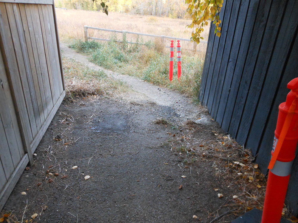
In October 2020, an offset gate was removed on the pathway to help improve accessibility for pedestrians and cyclists in the area.
Before
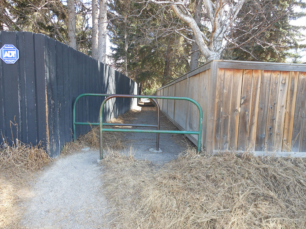
After
Medium-scale projects: Traffic calming measures
Traffic calming measures create slower streets where neighbours of all ages and abilities can connect and have access to safer travel options.
They may include speed humps, extended sidewalks, temporary curbs or curbs extensions and/or wheeling lanes.
Projects often begin with feedback from communities to identify and prioritize areas where changes are needed and to test and validate changes made on streets.
Cost for medium-scale projects: Between $75,000 and $250,000 each.
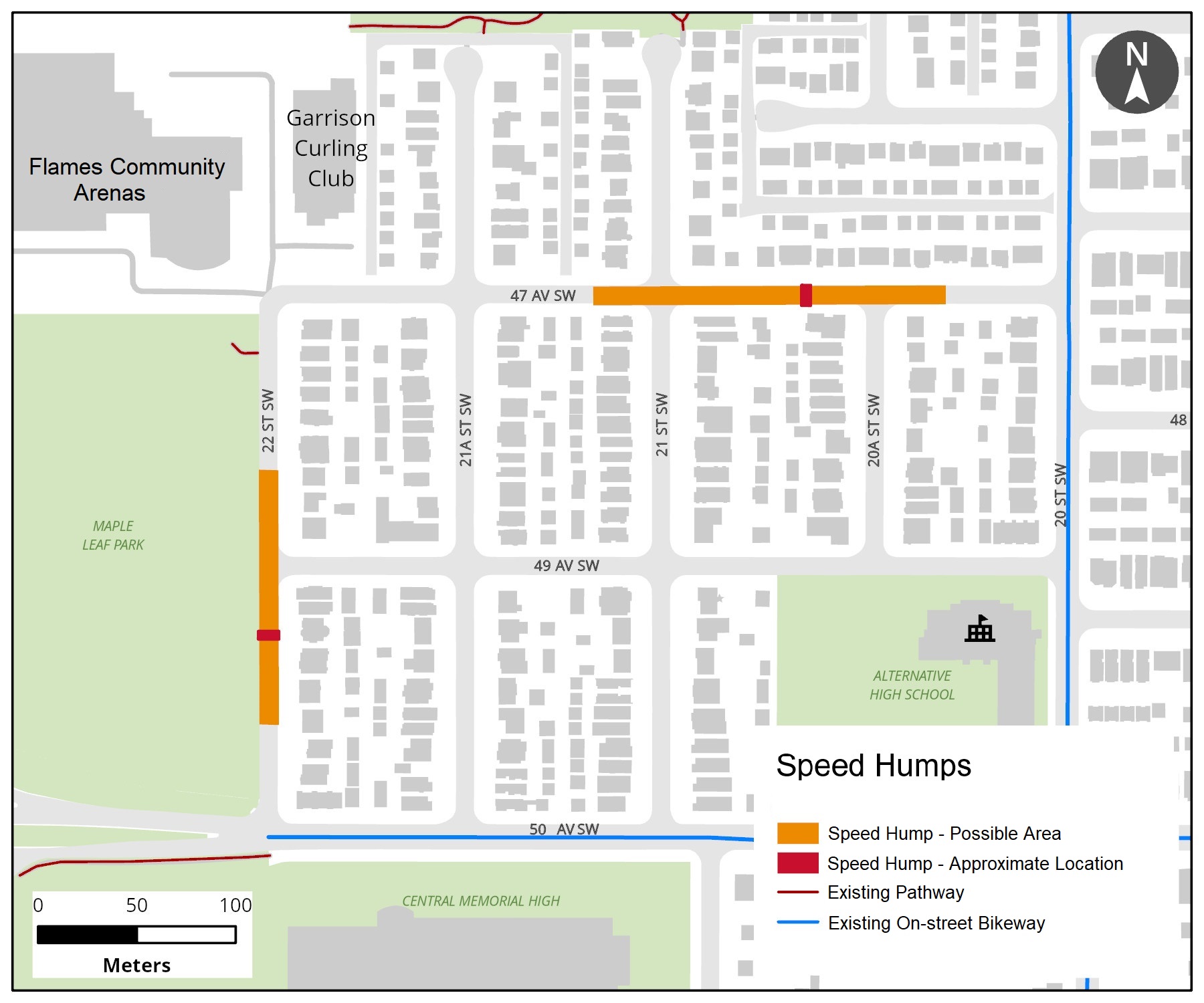
Altadore speed humps installation
In September 2021, speed humps were installed in Altadore on 22 Street S.W. and 47 Avenue S.W. to help slow vehicles down as they travel through the community.
With several schools, parks, and recreational facilities in the area, slower vehicle speeds make the streets safer while maintaining access for residents and visitors to the community however they choose to travel.
Large-scale projects: Community mobility improvements
The City collaborates with communities on large scale mobility improvements, or adjustments that can be made for Calgarians getting around (whether walking, driving or wheeling).
These projects involve extensive community engagement to learn about what challenges Calgarians face and how to address them through updated street designs and transportation improvements.
Cost for large-scale projects: More than $250,000 each.
Northeast
Marlborough Way N.E.
In 2020, a bus shelter was installed at Marlborough Way N.E., south of Maryvale Drive N.E. with a mini library and an interactive and colourful art installation created by local artist Daniel J Kirk.
Then in October 2021, a painted mural was created by the students of Bob Edwards School. This mural is an artistic interpretation of images, words, and phrases submitted by the students as a response to the theme "My Hope for the Future of Marlborough".
This artwork helped transform the space into an inviting, creative and vibrant public space for all Calgarians to enjoy.
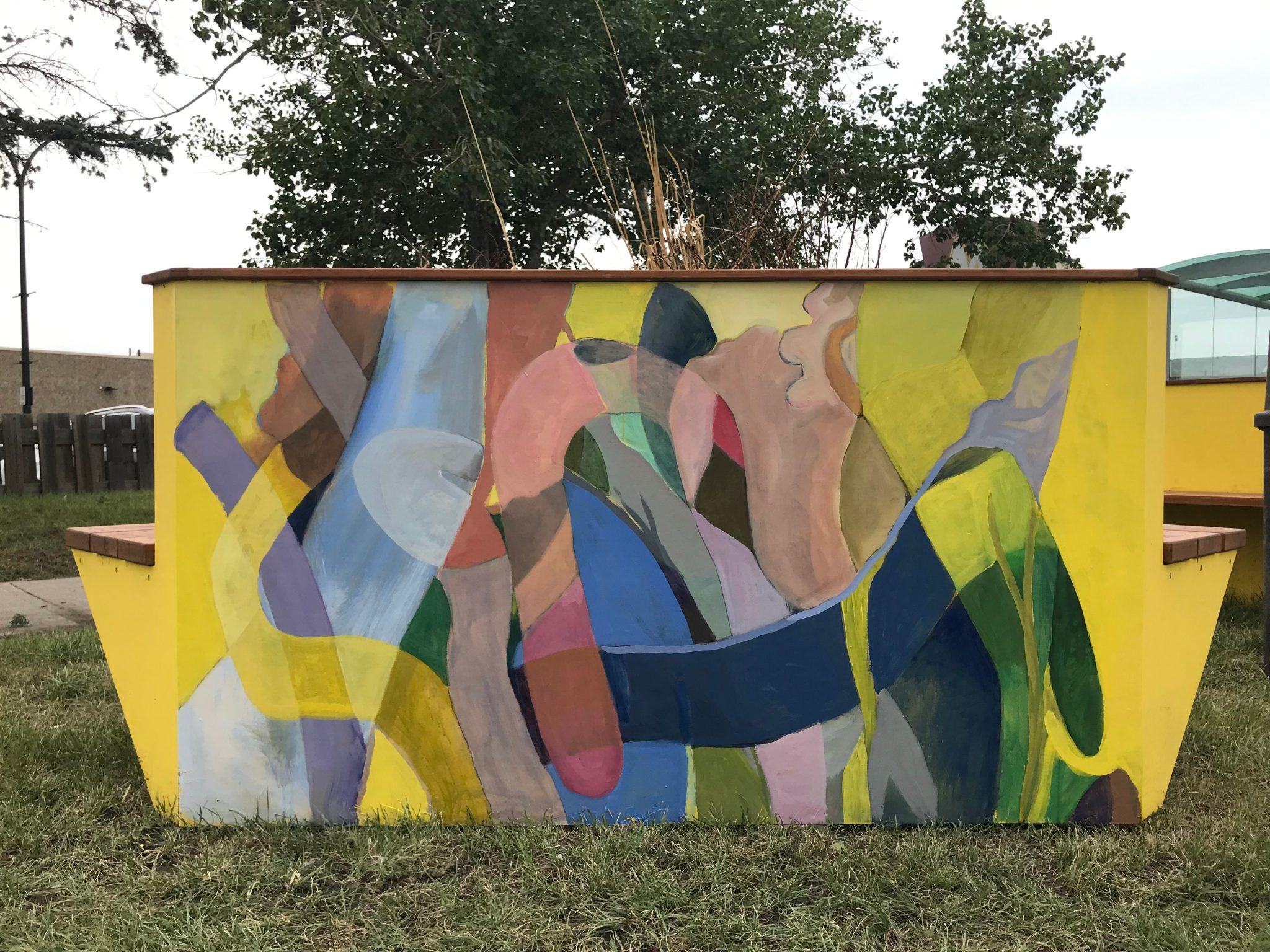
Mural photo submitted by students from Bob Edwards School
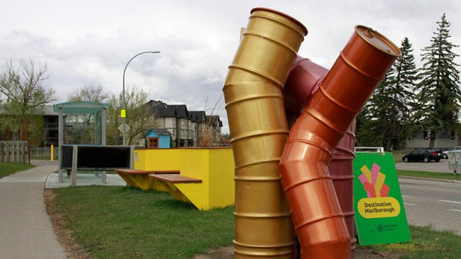
Destination Marlborough, located at Marlborough Way, south of Maryvale Drive N.E. - Photo provide by Kirsten Phillips / LiveWire Calgary
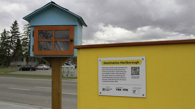
The mini library has a number of different books for people to enjoy while waiting for the bus. Photo provide by Kirsten Phillips / LiveWire Calgary
Northwest
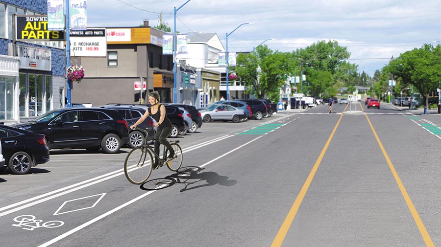
Bowness Road N.W.
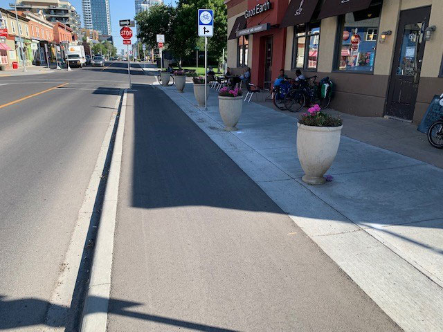
Bowness is a unique and historic business district. In the summer of 2019, several improvements were made along Bowness Road N.W. between 62 Street N.W. and 65 Street N.W. to help create a dedicated space on the road for people cycling and improve accessibility and connectivity to local businesses.
This included adding new road markings, installing painted on-street bike lanes, and new bicycle parking.
Southeast
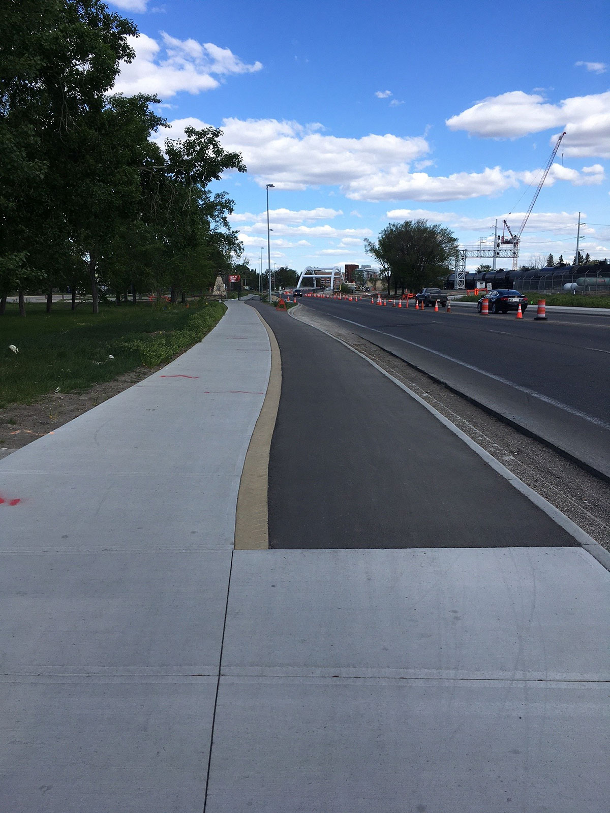
9 Avenue S.E. Route Improvements
9 Avenue S.E. is a key east-west link between downtown Calgary and Inglewood. In this area, we improved walking and wheeling by building a raised cycle track. This helped make the area safer for cyclists and pedestrians.
Before
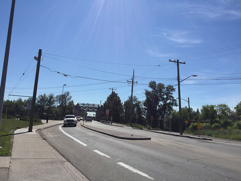
After
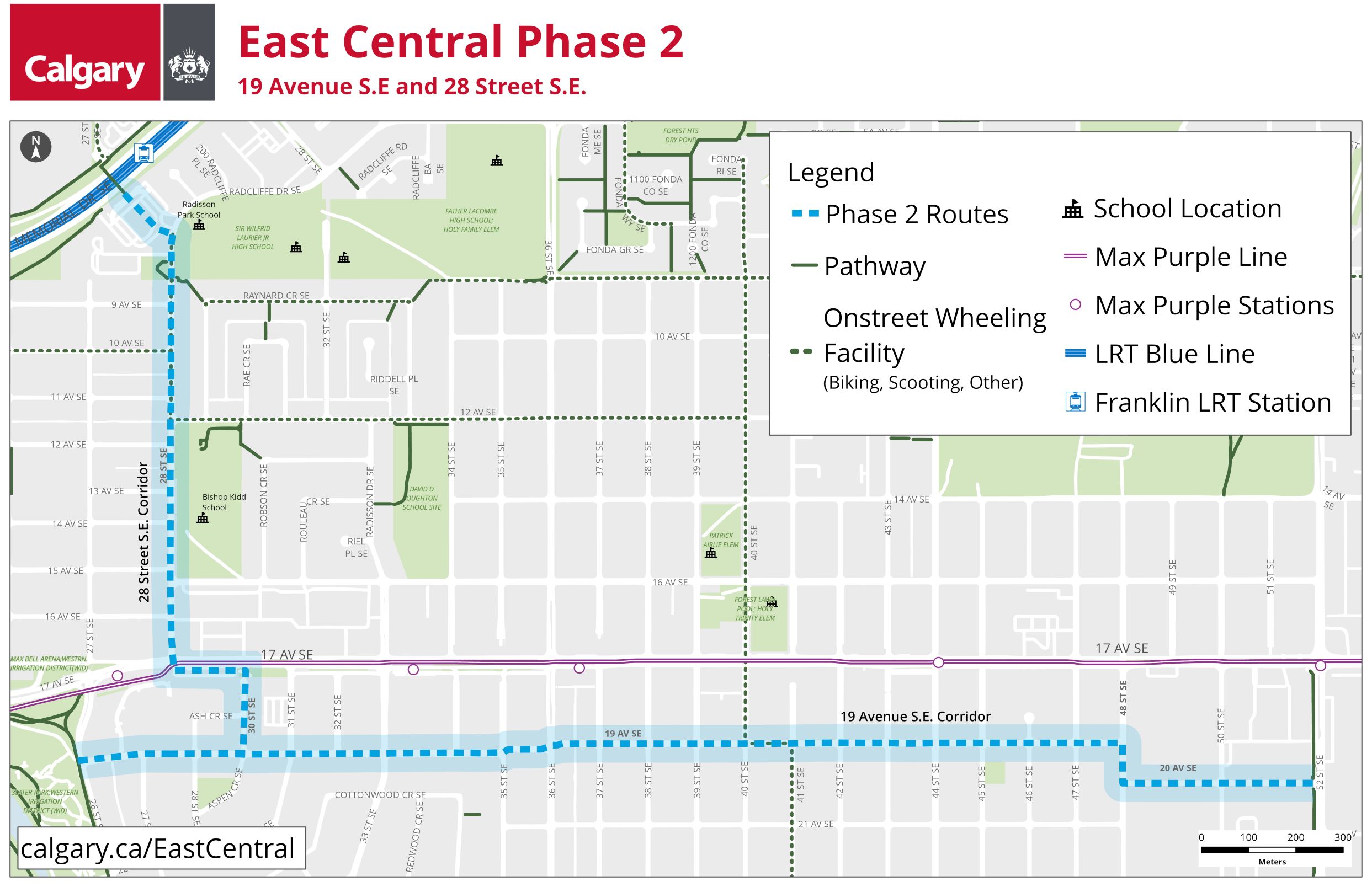
19 Avenue S.E.
The 19 Avenue SE corridor is part of the East Central Complete Street Network and is a key east-west link for Calgarians. Our investment in the area has improved access and connectivity for people who walk, wheel, and drive along 19 Avenue S.E. and 28 Street S.E. Specific improvements included:
- Improving walking and wheeling by building in missing sidewalks and a raised cycle track.
- Improving the design of key intersections to improve safety and predictability of road users.
- Promoting slower vehicle speeds by adding curb extensions to narrow the width of the road.
Before
After
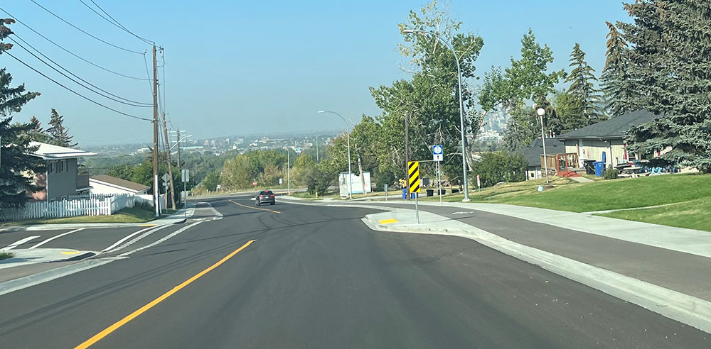
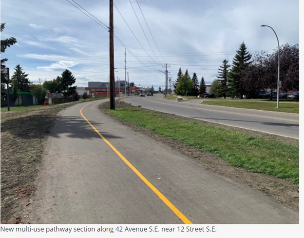
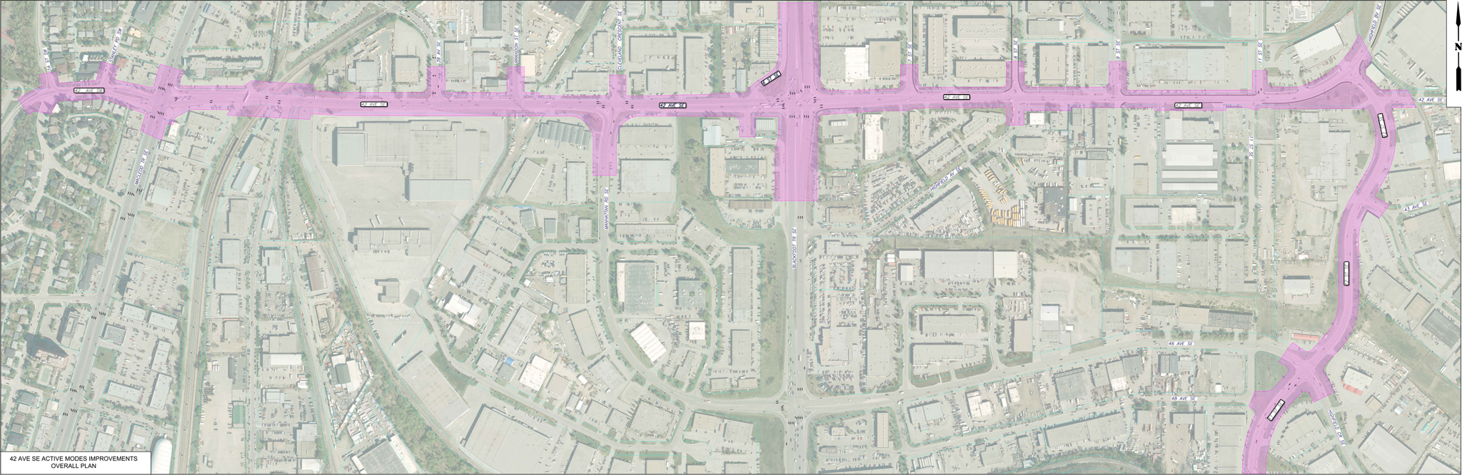
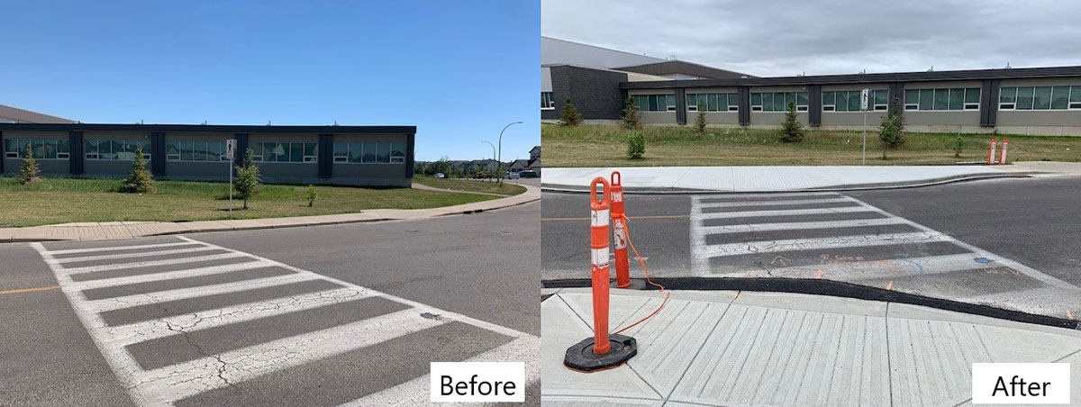
42 Avenue S.E. & 12 Street S.E.
In November 2021, upgrades were made to 42 Avenue S.E. and 12 Street S.E. that help connect the area to Stanley Park, LRT stations, local businesses, industrial parks, and the food bank and provide better access and connections in the area.
Specifically, these upgrades included:
- Adding a multi-use pathway.
- Completing missing sidewalk links and landscaping along the north side of 42 Avenue S.E.; and
- Upgrading existing concrete pedestrian islands, accessibility ramps and sidewalks.
28 Street S.E.
The 28 Street SE corridor provides a key connection within the Radisson Heights community and to the Franklin LRT station, the 17 Avenue Bus Rapid Transit (BRT), the Bethany Care Centre, Valleyview Park, West Dover Elementary school, St. Damien Elementary school, and nearby businesses.
In 2001, the City of Calgary invested in cycling and pedestrian infrastructure in this area, including adding sidewalks and traffic-calming measures, improving pedestrian crossings and accessibility, reviewing traffic controls, and adding wheeling facilities. This has resulted in improved safety, accessibility, and mobility for all modes of transportation along this corridor.
Southwest
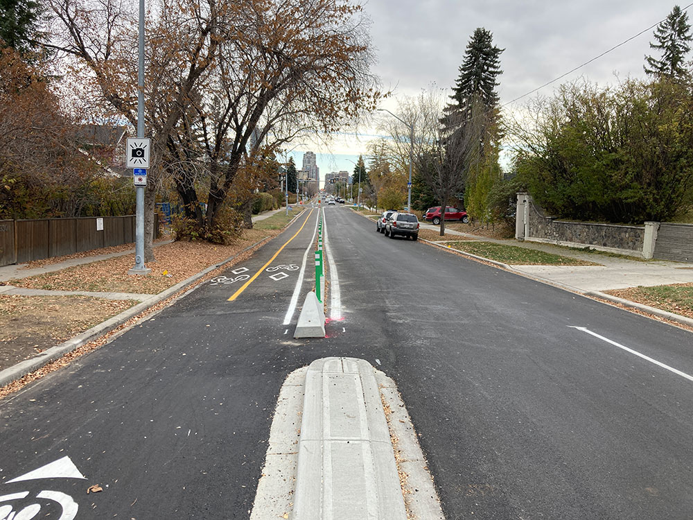
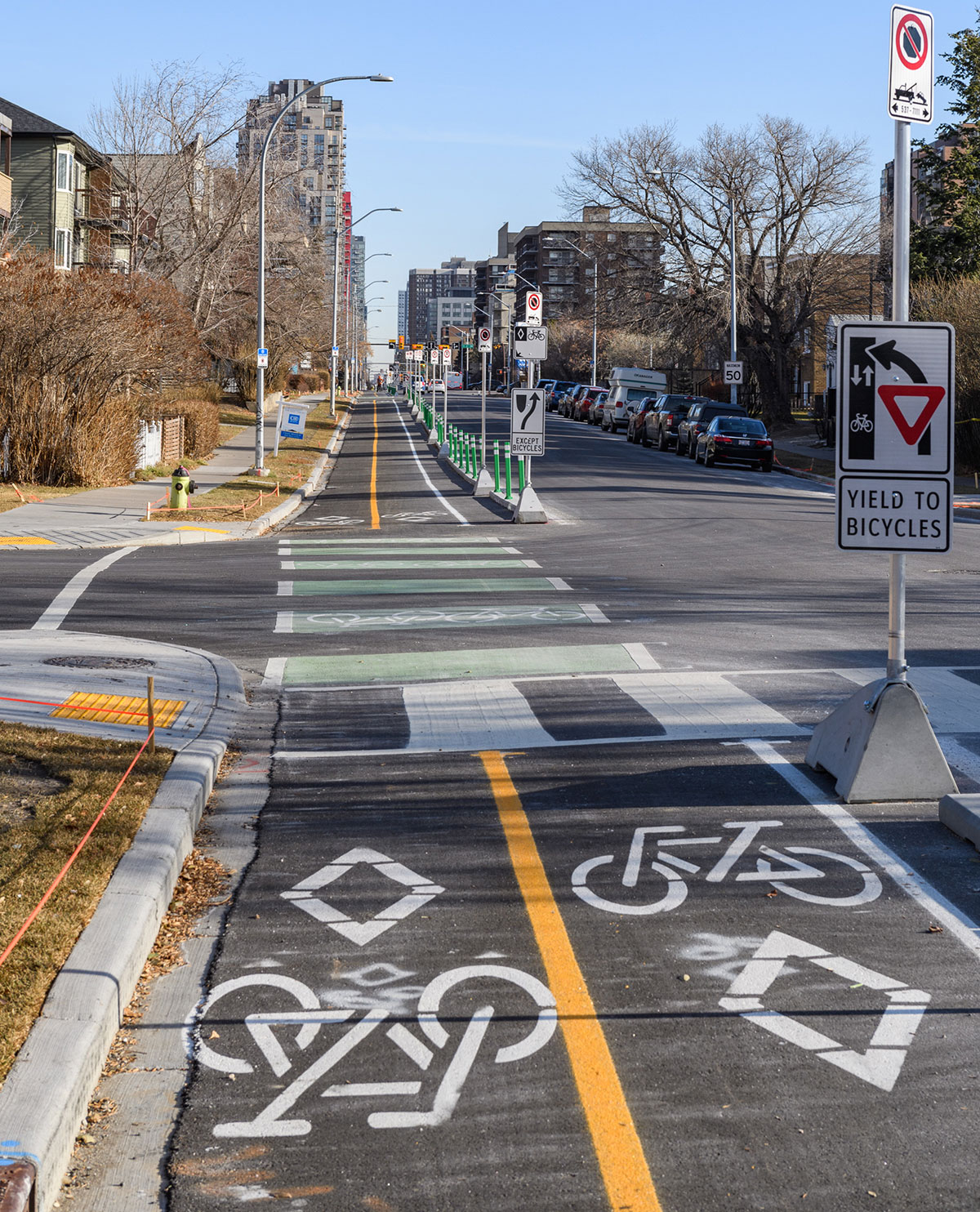
12 Avenue S.W.
In the fall of 2021, upgrades along 12 Avenue S.W. corridor to improve accessibility and safety for all modes of transportation. This includes:
- Extending the two-way cycle track facility on the north side of 12 Avenue S.W. from 15 Street to 19 Street S.W., and on the east side of 19 Street S.W. from 12 Avenue to 10 Avenue S.W.
- Providing a dedicated cycling facility for all ages and abilities, separated from vehicular traffic by a raised concrete median.
- Introduction of traffic-calming measures to reduce vehicle speeds while improving pedestrian and cyclist safety.
- Adding a connection for pedestrians and cyclists to the Bow River Pathway.
Before
After
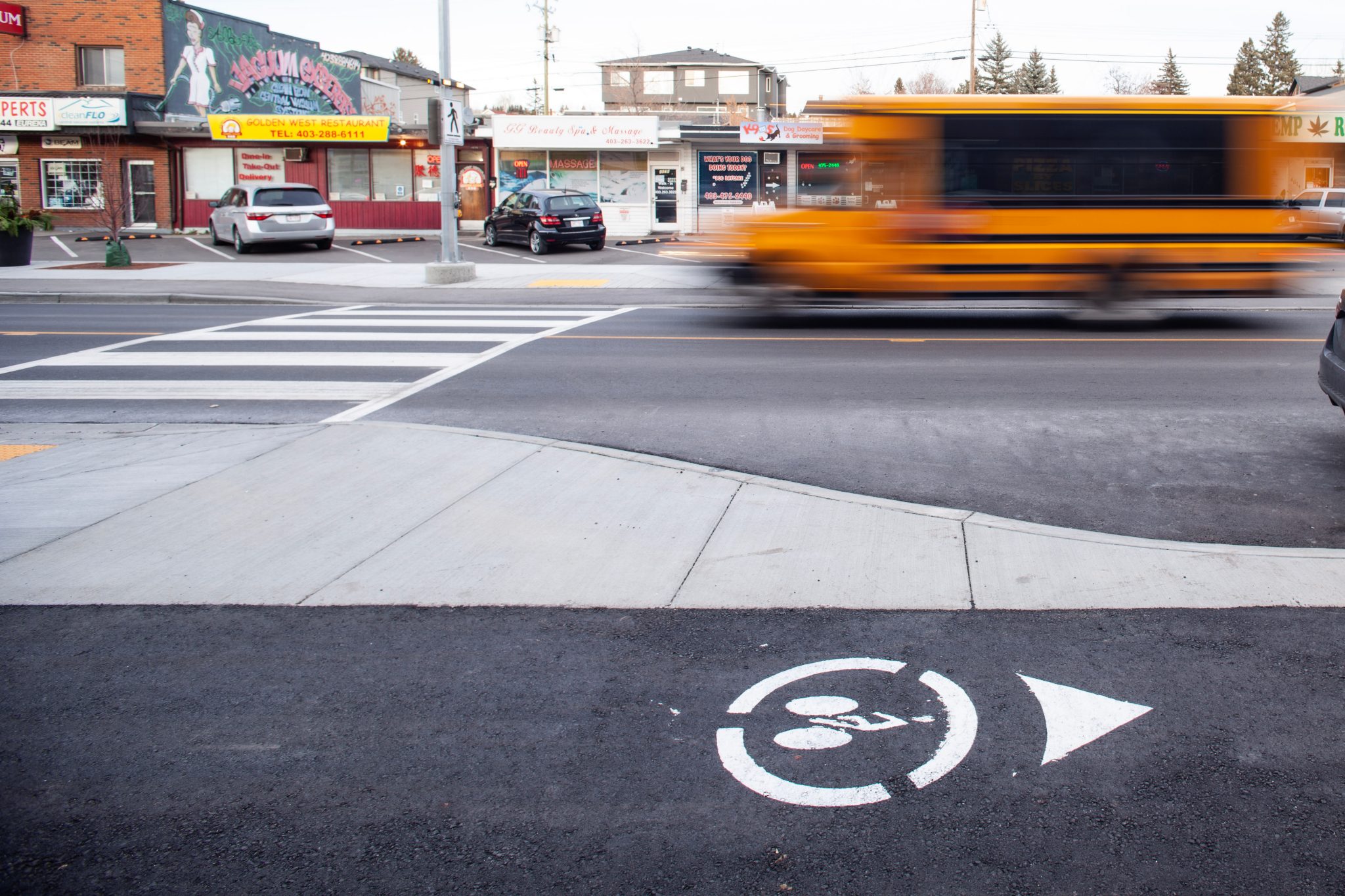
11 Street S.W.
In 2021, the City of Calgary invested in the cycling and pedestrian infrastructure on 11 Street SW so that safety, accessibility, and mobility would be improved for active modes of transportation along this corridor. The new cycling facility provides a connection from the existing cycle track on 12 Avenue SW to 16 Avenue SW, while also providing safer connections to nearby parks, Connaught Elementary school, and local businesses.
Specific improvements included:
- traffic-calming measures to help reduce vehicle speeds
- separated lanes for people cycling and scooting
- upgraded sidewalk ramps
- improved pedestrian crossings
Before
After
Other City of Calgary projects
Active and Safe Routes to School Program
The Active and Safe Routes to School Program (ASRS) collaborates with Ever Active Schools, and now includes 25 schools across the city.
The City of Calgary builds infrastructure improvements and upgrades like curb extensions and missing sidewalks.
Ever Active provides their ‘In Residence’ education and facilitation at program schools, diversifying their programming to include public transit safety sessions with Calgary Transit and winter cycling skills workshops with Two Wheel View.
Downtown Cycle Track
In the fall of 2021, upgrades along 12 Avenue S.W. corridor to improve accessibility and safety for all modes of transportation. This includes:
- Extending the two-way cycle track facility on the north side of 12 Avenue S.W. from 15 Street to 19 Street S.W., and on the east side of 19 Street S.W. from 12 Avenue to 10 Avenue S.W.
- Providing a dedicated cycling facility for all ages and abilities, separated from vehicular traffic by a raised concrete median.
- Introduction of traffic-calming measures to reduce vehicle speeds while improving pedestrian and cyclist safety.
- Adding a connection for pedestrians and cyclists to the Bow River Pathway.

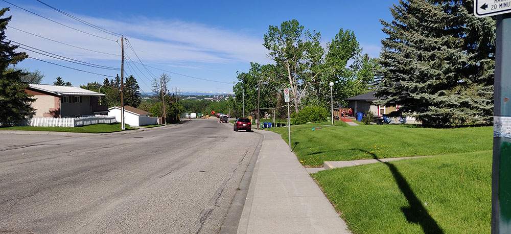
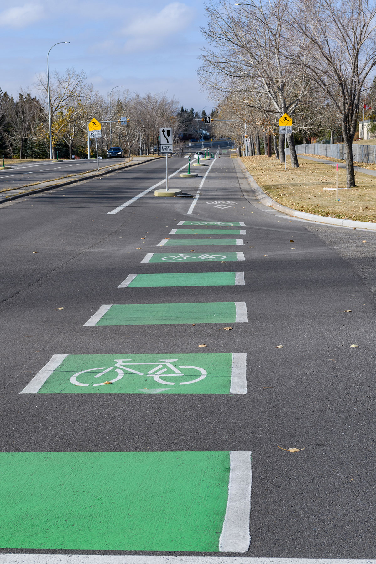
Neighbourhood Streets Pilot Policy
The Neighbourhood Streets Pilot Policy aims to create streets where neighbours of all ages and abilities can connect and have access to safe, comfortable travel options.
In 2021, 13 projects were implemented and included:
- 22 Street & 47 Avenue S.W. Speed Humps (Between 50 Avenue and 20 Street S.W.)
- 21 Street & 33 Avenue S.W.
- North Hill Area
- Panorama Hills Neighbourhood Streets Pilot 15
- Silver Springs Neighbourhood Streets Pilot
- Rosehill Drive N.W. Neighbourhood Streets Pilot (10 Street NW to 14 Street NW)
- 10 Street N.W. Neighbourhood Streets Pilot (Cambrian Drive NW to 32 Avenue NW)
- 34 Avenue S.E. Improvements in Dover
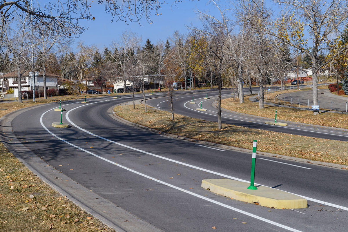
Silver Springs Neighbourhood Streets pilot
Silver Springs Neighbourhood Streets pilot
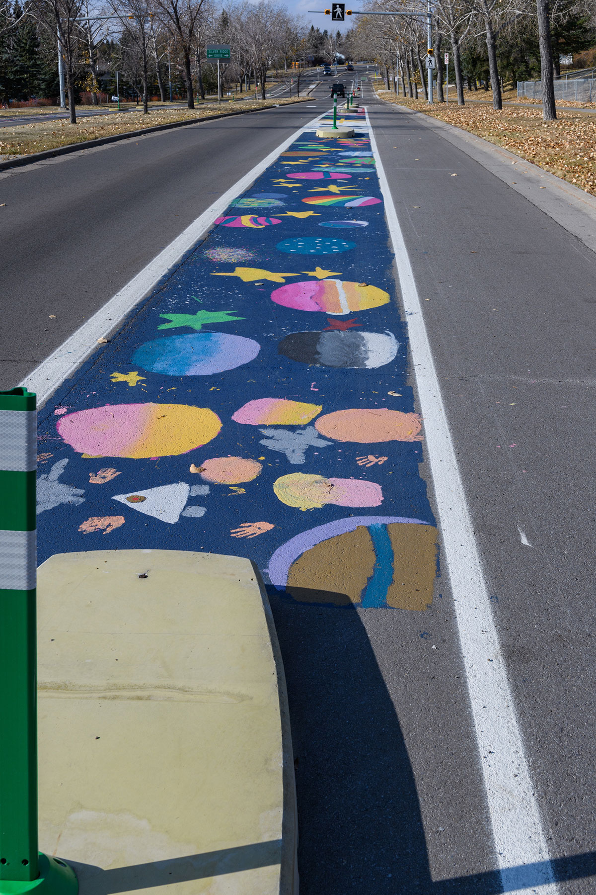
Silver Springs Neighbourhood Streets pilot