Cycling and walking route maps
Printed maps
Walking, biking and wheeling are great ways to stay active all year round. Plan your route with our Pathways and Bikeways Map. Limited print copies available so get your copy before they’re all gone! You can also use the interactive map or download a digital version.
Where to find print maps:
- City of Calgary recreational facilities including pools, arenas and golf courses
- Calgary AMA (Alberta Motor Association) locations
- Calgary Co-op Grocery Stores and gas bars
- Various local businesses and community associations
Click here for the most recent list of map providers. Please contact locations in advance to see if maps are in stock.
If you’d like a print map but have mobility barriers, call 311.
How to order maps
Are you a retail shop, recreation centre, school, community group, event, or tourism office?
We invite you to order our Pathways and Bikeways Map to share with your customers and members. One box contains 150 maps – order as many as you’d like (while quantities last) and we’ll deliver them to you.
Orders are filled on an as-needed basis. To order, please contact 311 and provide:
- Number of boxes requested (150 maps/box)
- Your name
- Organization name
- Phone
- Delivery address
- Would you like your organization to be added to our list of map locations?
Downloadable maps
Download PDF versions by clicking on the maps below:
- Whole City (3.2 MB)
- SW Quadrant (3.2 MB)
- NW Quadrant (4 MB)
- NE Quadrant (3.7 MB)
- SE Quadrant (2.9 MB)
- Downtown Core (3.3 MB)
Pathways and bikeways routes can also be found using the interactive map below.
How to plan your route
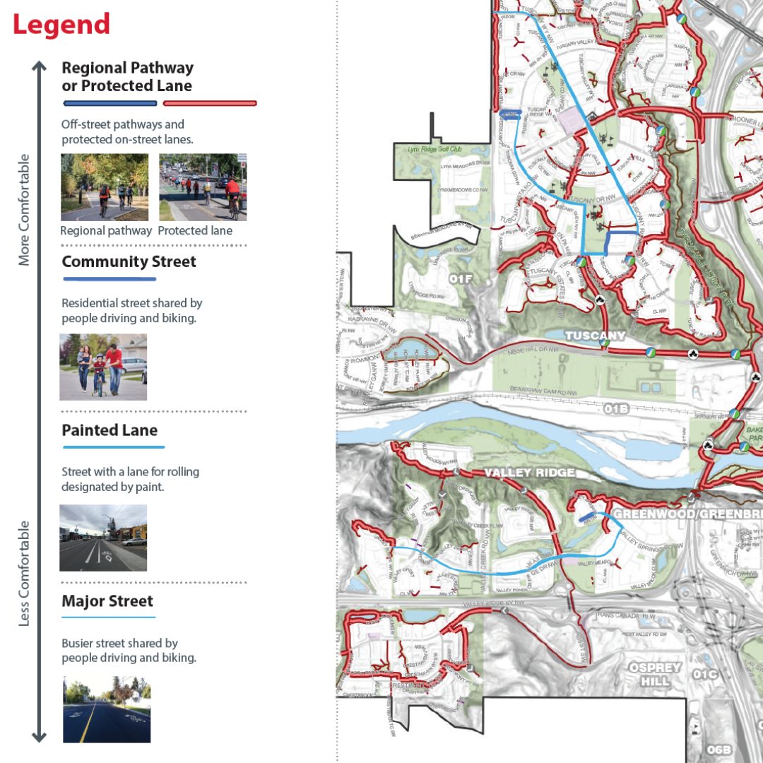
The map is designed to help walkers and wheelers confidently choose a route based on their comfort level. Pathways and bikeways are categorized by:
- High comfort: completely separated from vehicle traffic, including pathways and cycle tracks
- Moderate comfort: quiet residential streets or roads with dedicated cycling lanes
- Lower comfort: busier streets shared by people driving and biking
Know before you go
- Pathways and Trails (closures, detours, safety, and more)
- Learn your hand signals before you head out
- Glossary of cycling route types
- Pathways and Bikeways Map Educational Brochure (7MB)