Pathway closures
Notable Closures
Note: For additional unlisted pathway closures, visit the Pathway & Bikeways Map.
Bow River Pathway - Watermain related closures
To support ongoing watermain repairs, the Bow River Pathway is closed:
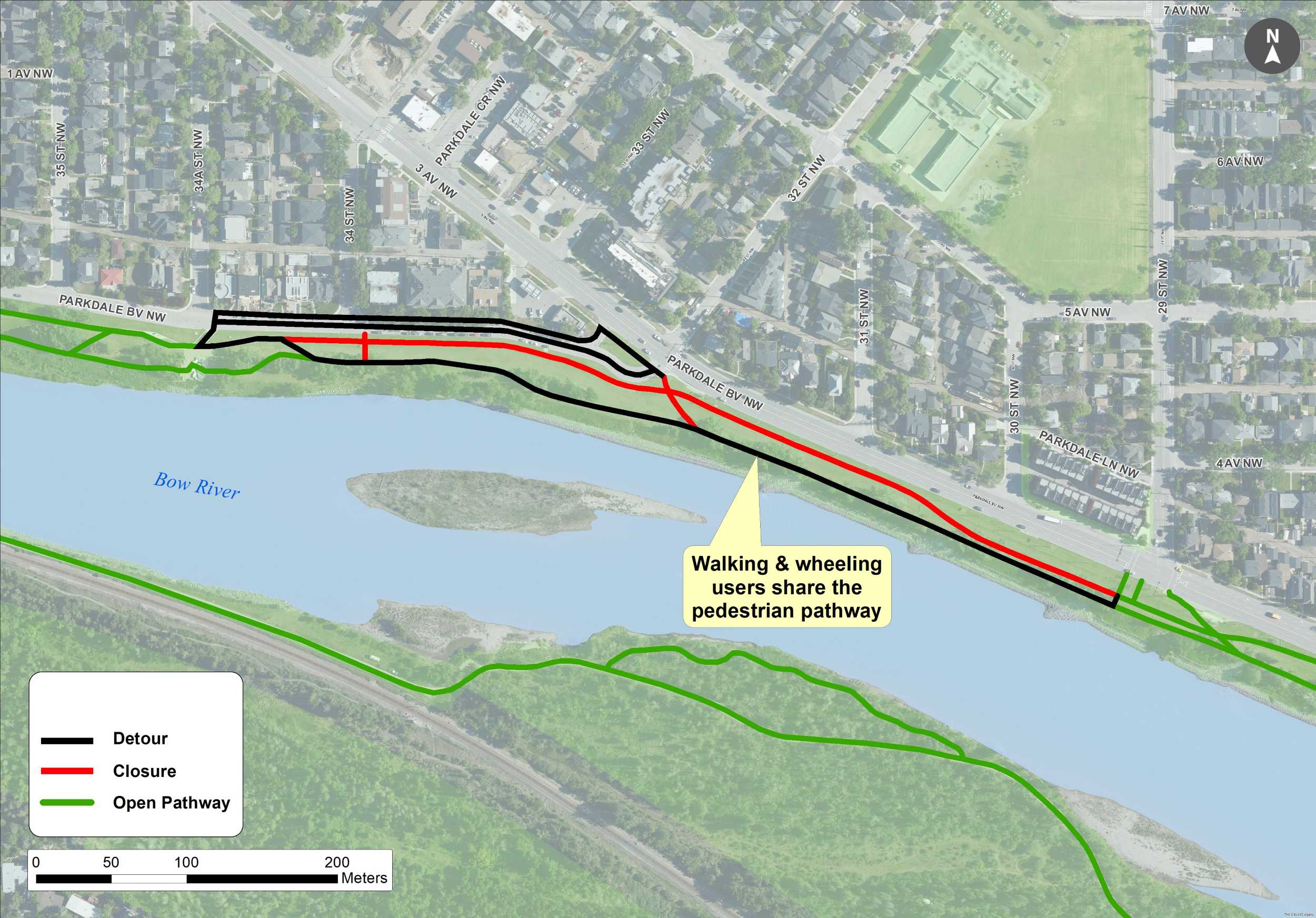
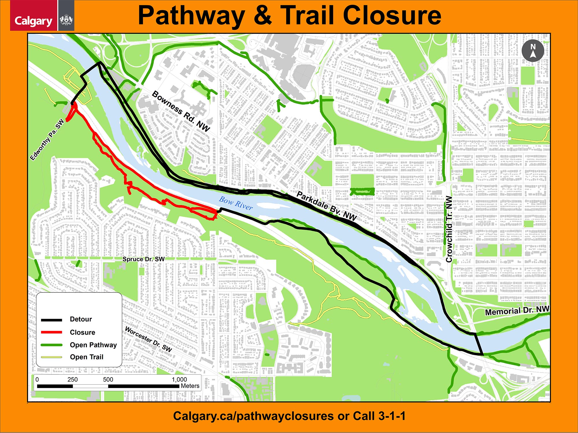
- Parkdale Boulevard N.W, between 34 Street N.W. and 29 Street N.W. until Summer 2026
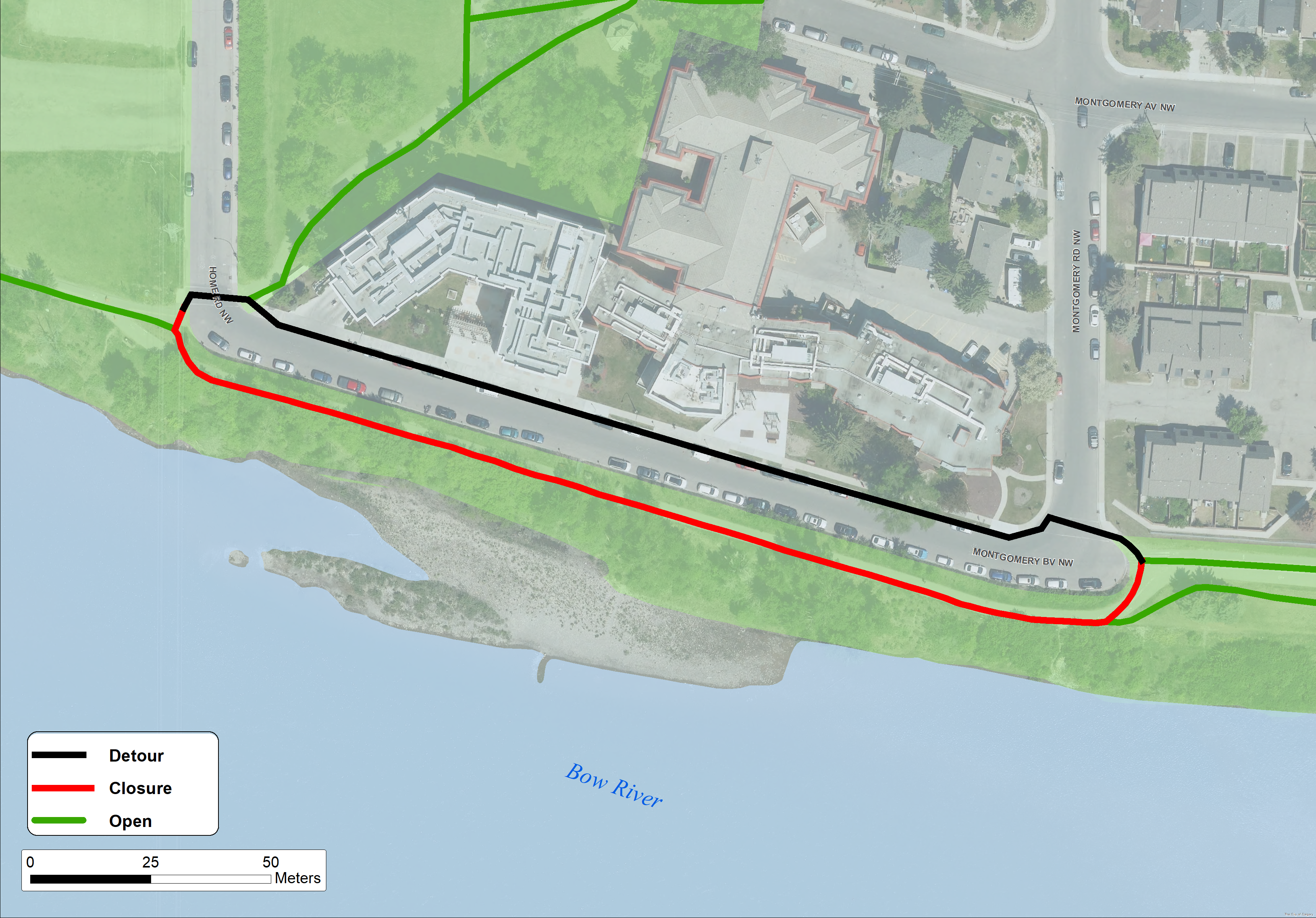
- Montgomery Boulevard N.W. until Summer 2026
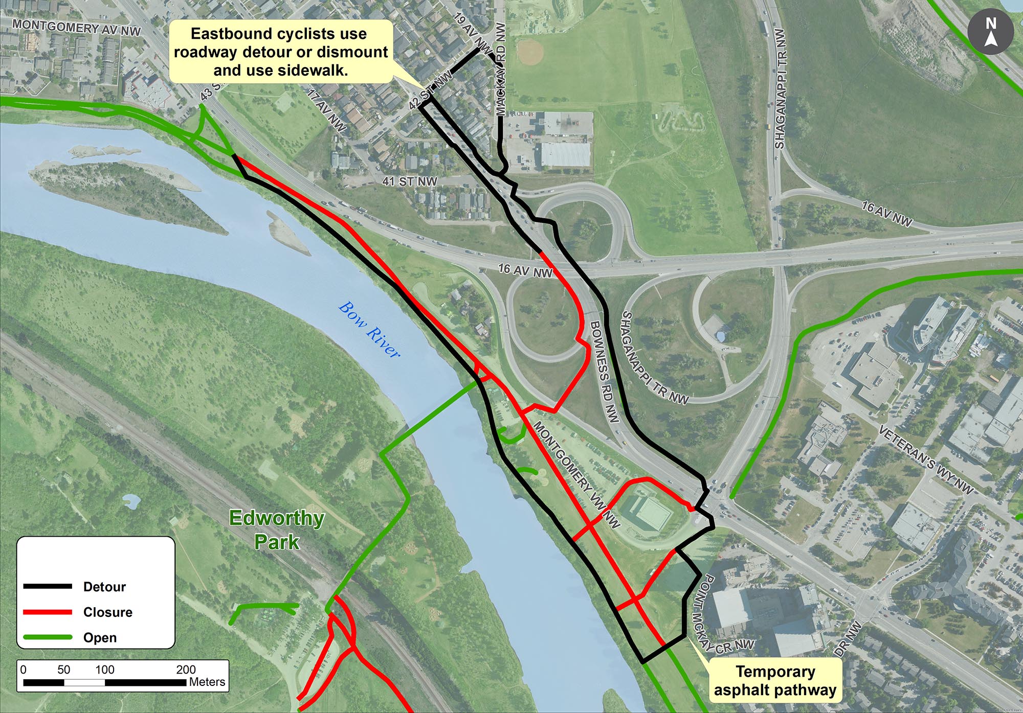
- North Edworthy Parking Lot and west of Montgomery View N.W. until December 2026
Please follow all detour signage in the area.
Long-term Closures
Bow River Pathway – Wildwood
- Starting September 9 until October 2026, the south Bow River Pathway east of Edworthy Park to the railway crossing, will be closed for a Douglas Fir Trail slope remediation project. This closure will also include the western half of Douglas Fir Trail. Please follow the detour signage to the north side Bow River Pathway.
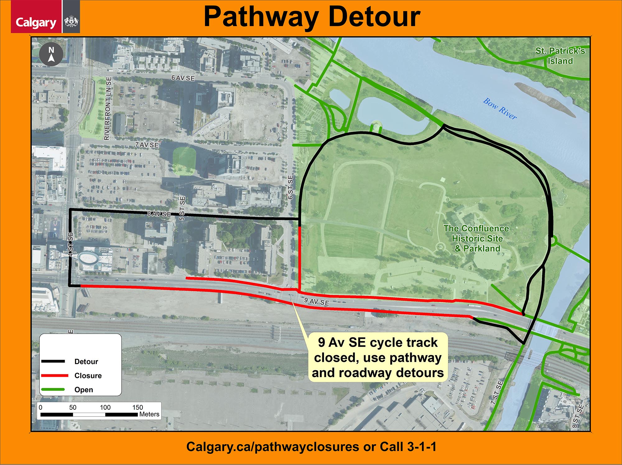
Downtown East Village (6 St S.E. & 9 Ave S.E.)
- A section of pathway and the 9 Ave S.E. cycle track is closed due the 6 Street Underpass Project, until December 2026. Please follow detour signage for the pathway and roadway detours around the site.
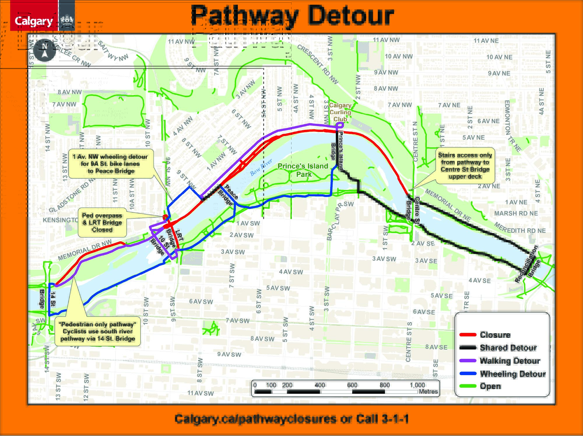
Bow River Pathway – Sunnyside Flood Barrier Closures
Sections of the north Bow River Pathway will be fully closed for Sunnyside Flood Barrier construction this year (dates estimated and subject to change):
- 14 Street N.W. to 10 Street N.W. wheeling pathway: April 13 - July
- 14 Street N.W. to 10 Street N.W. pedestrian pathway: July - September
- Memorial Dr. NW pedestrian overpass: Reopening date TBD
- LRT Bridge closure and pathway to 9 Street N.W.: April 6 - September
- 9 Street N.W. to Peace Bridge: July - October
- Peace Bridge to 7 Street N.W.: Until July
- 7 Street N.W. to Prince’s Island Park Bridge: Until September
- Prince’s Island Park Bridge to Centre Street N: April 1 - May
Summer months tend to be busy and Calgarians use our pathways and bikeways extensively. Periodically pathways may need to be closed due to maintenance, construction work or other unsafe conditions. Temporarily closing pathways and setting up detours allows work to be completed as quickly as possible, while keeping both citizens and workers safe.
Pathway closures due to slope stability follow best practice in slope stability management to ensure a safe re-opening. For more information, visit the Slope stability management policy and framework.
Thank you for your patience during construction.
Pathway closures map
All pathway closures shown on the map are currently closed for construction or due to hazardous conditions. Pathways not listed are considered to be open.
All posted closure dates are weather dependent and subject to change.
Pathway closures/detours & access/proximity ePermits and manual
-- Found under Roads ePermits --
Private contractors, consultants, utility companies, and City personnel that require a closure of a City of Calgary pathway, due to construction should refer to the manual.
Governed by Bylaw 11M2019 (“Bylaw to Regulate the Use of Parks & Pathways”) Section 22 stipulates that “any work taking place within 5 meters of the edge of a pathway must have a permit.” This can be related to work commencing in access/proximity or requiring closure and detour of a City pathways involving underground utility work, construction, or any event that is impacting/in proximity to a pathway involving equipment/vehicles access/egress or temporary installations.
Snow on our pathways
Is it snowing? To make it easier for Calgarians to use the pathway system, maintenance activities include clearing snow from approximately 400 kilometers of paved (regional) pathways, usually within 24 hours of a snowfall. Be sure to check out the latest information about snow clearing on Calgary’s pathways.