Anderson Station Area Redevelopment Plan
The proposed area redevelopment plan was presented to the Calgary Planning Commission on April 20, 2017. It will now proceed to the Public Hearing of Council on June 12, 2017.
Anderson Station ARP - proposed
Story boards from our information session in November 2016 are available for review.
The Plan
What's covered in the plan?
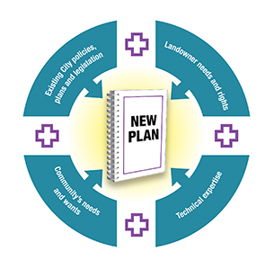
- Land Use and Development
- Public Realm: Parks and Open Space
- Mobility: Street Network, Pedestrian & Cycling Network, Transportation Study, Parking
- Built Form and Site Design
- Implementation
UPDATE
The proposed Anderson Station Area Redevelopment Plan (ARP) has now been finalized by Administration and was presented to Calgary Planning Commission (CPC) at their April 20th, 2017 meeting. CPC voted to refer the Plan to City Council with a recommendation of approval with some amendments.
CPC approved the following amendments in their referral to City Council:
- Increasing the height of the “Central Retail Area” block north of Willow Park Drive SE and east of Macleod Trail S from 12-32 metres to 46 metres with the same 30m buffer strip along Bonaventure Drive SE as exists south of Willow Park Drive SE.
- Changing the “Regional Shopping Centre Area” (Southcentre Mall site) from the Community – High Density building block proposed by Administration, to the Future Comprehensive Planning Area building block.
- Deleting Appendix C, the Urban Design Guidelines for the Anderson Station Area.
The Anderson Station ARP will now move on to the Public Hearing of Council on June 12, where Council will review the ARP and the public will have an opportunity to speak to the item in front of Council.
Click on the “Contact to provide comments” tab for details on how to give feedback to Council or Administration.
Policies and Plans
Policy overview
The City of Calgary's Municipal Development Plan (MDP) and the Calgary Transportation Plan (CTP) provide vision for how and where Calgary grows over the next 60 years. They focus on a more compact city that's made up of complete communities. A complete community consists of neighbourhoods designed to offer safe and easy pedestrian access for shopping, opportunities for cycling and commuting on public transit, and that preserve and enhance open space.
A key objective of these plans is to establish a land use framework that optimizes population and job growth within walking distance of transit. Referred to as Transit Oriented Development (TOD), this form of development optimizes use of the transit network, and creates mobility options for the local community. Successful TOD provides a mix of land uses and densities, creating a convenient, pedestrian-friendly, interesting and vibrant community for local residents and visitors alike.
Station area plan
In 2007, City Council directed Administration to prepare a Station Area Plan (SAP) for the lands around Anderson Station Map of SAP & OP/LUP Lands.
Built on the principles of TOD, the Station Area Plan will provide strategic direction for the comprehensive redevelopment of the Anderson station area. Included in the plan will be land use policies, building limits for heights and densities, public spaces, new connections or improvements to the existing pedestrian, bicycle, transit and roadway systems, as well as guidance for the implementation of the plan.
Outline plan & land use redesignation application
While the Anderson Station Area Plan will set the City's and communities' overall vision and policy direction for the area, the aspirations and development timing for individual pieces of land are set by each land owner. The City of Calgary owns the 20 acres of land that currently accommodates the Anderson LRT Station, bus terminal and park and ride.
The City’s Real Estate and Development Services division has been directed by City Council to prepare detailed designs plans for transit oriented development on this land, outlining future roads and parks, desired types of land uses, building densities and heights in the form of an Outline Plan and Land Use Redesignation Application.
The Planning department has been working with the Real Estate & Development Services group throughout the development of this policy to ensure that the City-owned lands will be developed to help achieve the overall vision for the area.
The details of the redevelopment of the Anderson Station Park and Ride site is being reevaluated by the Real Estate & Development Services team and is not being contemplated as part of this ARP proposal at this time.
Timeline
| Date | Purpose |
|---|---|
| Date: June 12, 2017 | Purpose: City Council is expected to review and hold a Public Hearing on the revised Anderson Station Area Redevelopment Plan (ARP). |
| Date: April 20, 2017 | Purpose: CPC reviewed the Anderson Station ARP and referred the plan forward to the June 12, 2017 Public Hearing of Council with a recommendation of Approval, with amendments. |
| Date: December 15, 2016 | Purpose: CPC approved an Administration request to have the Anderson Station ARP tabled to CPC no later than June 30, 2017 |
| Date: October 2016 | Purpose: City Council approved a new approach for the park and ride stall plan for the Anderson Station Transit Oriented Development (TOD) site. During redevelopment, stall numbers reduced at Anderson Station would be replaced at other Red Line and future Green Line LRT stations. |
| Date: November 19, 2015 | Purpose: CPC approved an Administration request to have the Anderson Station ARP tabled to return to CPC no later than December 15, 2016. |
History
The Anderson Station Area Redevelopment Plan (ARP) was presented to the Calgary Planning Commission (CPC) on August 27, 2015. Calgary Planning Commission referred the item back to Administration to return no later than 2015 December 17 in order to:
- Review the appropriateness of the boundaries of the plan area and amend/adjust as appropriate.
- Incorporate Complete Streets guidelines or provide rational for deviation.
- Develop a staging plan that address when the C-Train parkade/garage structure is to be in place.
- If easterly boundary includes Willow Park Village and South Centre Mall, etc. Address/identify opportunities for redevelopment (intensification) of land to the east of MacLeod Trail.
- Address the future potential use, servicing and linkage to the Calgary Transit Anderson yard site.
- Amend Map 2.2 to change transition to low density residential on west side to "Building Set Back Rail Right of Way". Add "Transition to Low Density Residential" to west of "Building Set back from Rail Right of Way".
- Review all maps to be consistent with street names and road alignment, throughout the document. (i.e. Map 1.1 to include Southport Road, 99 Avenue & Willow Park Drive SE).
- Review photo imagining, to confirm image supports policy and label its intent.
- Add Glossary of definitions.
- As noted Page 17 paragraph 2 there are incomplete thoughts that require review and editing throughout the document.
- Add Appendix C "Urban Design Guidelines for Transit Hub".
- Ensure "North" arrows are on right for mapping consistency. (as noted on Map 1.1 where the arrow is in the left corner and very small).
- Review section 4.1 "Streetscape Design" for consistency with diagrams and text (i.e. sidewalk dimensions).
- On November 19, 2015 CPC approved an Administration request to have the Anderson Station ARP tabled to return to CPC no later than December 15, 2016.
- On December 15, 2016, CPC approved an Administration request to have the Anderson Station ARP tabled to CPC no later than June 30, 2017.
What's an ARP
An Area Redevelopment Plan, or ARP, is one of the tools The City uses to regulate development. It sets high-level requirements that future development will have to meet for an area. The APR outlines general rules such as:
- Where certain sizes and types of buildings should be located.
- Where amenity space and other public infrastructure should be located.
- How the land can be used in a general sense (commercial, residential, retail, etc)
- What improvements to infrastructure are needed to accommodate any changes.
Contact to provide comments
If you have any questions about the Anderson Station ARP prior to June 12, please email the project manager, Angelique Dean at angelique.dean@calgary.ca
Council
The Plan will be on the agenda for the Public Meeting of Council on June 12, 2017, at Council Chamber, Calgary Municipal Building, 800 Macleod Trail S.E., commencing at 9:30 a.m.
To provide feedback:
- Contact City Clerks at 403-268-5861 for information on presenting to Council.
- Present your view to Council
People wishing to address Council on this matter may do so for a period of five minutes. If you'd like to distribute additional material at the meeting, please supply the City Clerk with 35 copies at the time of the presentation. Additional material requires the approval of the Mayor before distribution to Members of Council.