Calgary’s Pathway and Bikeway Projects (5A)
Calgary’s Pathway and Bikeway Projects (5A)
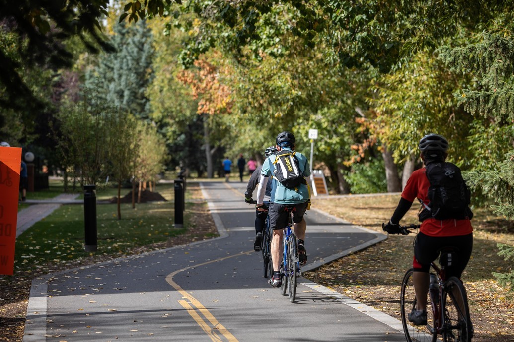
We are building a city where everyone has access to safe, healthy, and affordable travel options, year-round. Our pathway and bikeway network is guided by five principles: Always Available for All Ages & Abilities (5A).
Our network of pathways and bikeways spans the city, improving access to workplaces, schools, parks, and local destinations while enhancing safety and connectivity for all.
We're committed to expanding this network over the next 60 years by filling gaps, adding features, and supporting the daily, essential activities of Calgarians such as walking, cycling, and scootering. With over 4,000 km of pathways and bikeways mapped out for the future of travel in Calgary, these new enhancements and paths will create more vibrant and connected communities.
What we are building
2026 pathway construction projects
Northeast pathway projects
| Location | Project description | Status |
|---|---|---|
|
Location
:
68
Street E. (Applewood Drive S.E. to Abbotsford Drive N.E.) |
Project description : A new 2.4-kilometre multi-use pathway is being built along the east side of 68 Street N.E., between Abbotsford Drive N.E. and Applewood Drive S.E. This pathway will provide a dedicated space for people to safely walk and wheel through the community and will connect to the city’s larger network of pathways and bikeways. | Status : In progress: Construction began in August 2025 and is expected to be complete in fall 2026. |
| Location : | Project description : A new 700-metre multi-use pathway on the south side of McKnight Boulevard N.E. will connect the existing pathways on 47 Street N.E and 52 Street N.E. | Status : In progress: Pathway construction started in 2025 and major work is now complete. Crews are finishing a few minor outstanding items and completing the remaining landscaping work. |
|
Location
:
32 Avenue N.E. (12 Street N.E. to Barlow Trail N.E.) |
Project description : A new 1.9-kilometre multi-use pathway on the north side of 32 Avenue N.E. will replace segments of sidewalk and informal trail. | Status : In progress: Construction began in 2025 and is expected to be complete in Fall 2026 |
|
Location
:
Falconridge Boulevard N.E. (Falsbridge Gate N.E. to Taradale
Drive N.E.) |
Project description : The 1.9-kilometre multi-use pathway on the east side of Falconridge Boulevard N.E. will replace the sidewalk and connect to the 52 Street N.E. Pathway. | Status : In progress: Construction began in 2025 and is expected to be complete in Fall 2026 |
| Location : | Project description : A new 1.4-kilometre multi-use pathway along 36 Street N.E. will connect existing pathways at McKnight Boulevard N.E. and 16 Avenue N.E. Construction is being coordinated with planned repaving on 36 Street N.E. | Status : In progress: Pathway construction is underway between 37 Avenue N.E. and 32 Avenue N.E. |
|
Location
:
Ward 5 pathway and bikeway connections |
Project description : New pathways and bikeways will be constructed at 12 sites at various locations in Ward 5. This project will complete many missing links and connect to The City’s larger network of pathways and bikeways. | Status : Planned for 2026 |
Northwest pathway projects
| Location | Project description | Status |
|---|---|---|
|
Location
:
87 Street N.W. (Nose Hill Drive N.W. to Bearspaw Dam Road N.W.) |
Project description : The new 300-metre multi-use pathway will connect Bearspaw Dam Road N.W. to Nose Hill Drive N.W., linking users to nearby pathways. | Status : Planned for 2026 |
|
Location
:
Memorial Drive (Riley Community - Sunnyside
Flood Barrier Project) |
Project description : As part of the Sunnyside Flood Barrier construction, the adjacent Bow River pathway will be rebuilt. The pathway will be wider and provide separation of wheeling and walking traffic. | Status : In progress: Construction began in 2025 and is expected to be completed in 2026 |
|
Location
:
14 Street N.W. (Berkshire Boulevard N.W. to Hidden Valley Drive
N.W.) |
Project description : A 1.7-kilometre multi-use pathway will replace segments of sidewalk and informal trail, connecting many existing pathways in the area. | Status : In progress: Construction began in 2025 and is expected to be complete in 2026 |
Southeast pathway projects
| Location | Project description | Status |
|---|---|---|
|
Location
:
36 Street S.E. (Memorial Drive E. to 8 Avenue S.E.) |
Project description : This new 1.4-kilometre multi-use pathway will connect many existing pathways, including the new pathway on Memorial Drive from 36 Street N.E. to Marlborough Way N.E. | Status : In progress: Construction began in 2025 and is expected to be complete in 2026 |
| Location : | Project description : This 2.1-kilometre multi-use pathway will replace segments of sidewalk and informal trail. When complete, it will connect to the city’s network of pathways and bikeways and provide a dedicated space for people to safely walk and wheel through the community. | Status : In progress: Construction began in 2025 and is expected to be complete in 2026 |
Southwest pathway projects
| Location | Project description | Status |
|---|---|---|
| Location : | Project description : A 630-metre pathway extension will be built from 19 Street S.W. to 22 St S.W replacing the existing sidewalk. This will result in a completed pathway connection from Sandy Beach to Mount Royal University. | Status : Planned for 2026 |
|
Location
:
90 Avenue S.W. (14 Street S.W. to 24 Street S.W.) |
Project description : The new 1.2-kilometre multi-use pathway on the north side of 90 Avenue S.W. will provide a more accessible alternative to the current sidewalk and connect many existing pathways. | Status : In progress: Construction began in 2025 and is expected to be complete in 2026 |
-
Contact us
Questions about pathway projects under construction?
2026 Rectangular Rapid-Flashing Beacon (RRFB) projects
RRFBs help make crosswalks safer for pedestrians. When someone wants to cross, they press a button that turns on bright, flashing lights – similar to emergency vehicle lights – to grab drivers’ attention. The lights keep flashing until the person finishes crossing, so drivers know to stay alert the whole time.
Learn more about planned RRFB locations and installation criteria.
Northeast RRFB projects
| Location | Status |
|---|---|
| Location : Taradale Drive & Taralake Way N.E. | Status : Planned for 2026 |
| Location : Red Embers Gate & Redstone Drive N.E. | Status : Planned for 2026 |
| Location : California Boulevard & Catalina Boulevard N.E. | Status : Planned for 2026 |
| Location : Martha’s Way & Martindale Boulevard N.E. | Status : Planned for 2027 |
| Location : 13 Avenue/Radnor Avenue & Russet Road N.E. | Status : Planned for 2026 |
| Location : 26 Avenue & Rundleson Way N.E. | Status : Planned for 2027 |
Northwest RRFB projects
| Location | Status |
|---|---|
| Location : Hawksbrow Drive & Hawkwood Boulevard N.W. | Status : Complete |
| Location : Evanscove Circle & Evanston View N.W. | Status : Planned for 2026 |
| Location : Royal Oak Park & Royal Oak Way N.W. | Status : Planned for 2026 |
| Location : 8 Avenue & 19 Street N.W. | Status : Planned for 2026 |
| Location : 300 Bermuda Drive N.W. | Status : Planned for 2026 |
| Location : Panamount Boulevard & Panamount Hill N.W. | Status : Planned for 2026 |
| Location : Sherwood Boulevard & Sherwood Way N.W. | Status : Planned for 2026 |
Southeast RRFB projects
| Location | Status |
|---|---|
| Location : Sun Valley Boulevard & Sun Valley Drive S.E. | Status : Planned for 2026 |
| Location : Sun Valley Boulevard & Suncrest Way S.E. | Status : Complete |
| Location : Auburn Bay Boulevard & Auburn Bay Street S.E. | Status : Planned for 2026 |
Southwest RRFB projects
| Location | Status |
|---|---|
| Location : 50 Avenue & 6 Street S.W. | Status : Planned for 2026 |
| Location : 40 Avenue & 20 Street S.W. | Status : Planned for 2026 |
| Location : Somerset Drive & Somerset Gate S.W. | Status : Planned for 2026 |
| Location : Palliser Drive & 29 Street S.W. | Status : Planned for 2026 |
| Location : 9 Avenue & 14 Street S.W. | Status : Planned for 2026 |
| Location : 26 Avenue/Spring Willow Terrace & 77 Street S.W. | Status : Planned for 2026 |
| Location : Silverado Boulevard & Silverado Ponds Way S.W. | Status : Planned for 2026 |
What we are planning
-
Improving connectivity and safety in S.E. Calgary by adding cycling and pathway infrastructure and traffic calming measures to the Ward 11communities of Acadia, Maple Ridge, and Willow Park.
-
Developing dedicated pathway and bikeway routes in the communities of Elboya, Windsor Park, Meadowlark Park, Kingsland, Haysboro, and Southwood. These projects will focus on routes that serve students, recreation, shopping, and work destinations.
-
Developing dedicated pathway and bikeway routes in Pineridge, Temple, Rundle and Whitehorn. These connections will focus on routes that serve students, recreation, shopping, and work destinations.