Annual Paving Program
The City of Calgary’s annual paving program is active between May and October (weather permitting). The 2025 Annual Paving program is a planned service program that will see 530 lane kilometres of Calgary’s roads paved at 320 locations across the city.
Paving projects rehabilitate roads that have degraded over time due to age. By performing preventative maintenance, such as resurfacing roadways, the annual paving program helps prevent more expensive and disruptive road reconstruction work in the future.
A typical paving project is completed in several steps:
- Paving projects are identified and scheduled in the fall/winter; this also includes working with other utility providers to ensure there are no conflicts or planned work.
- In the spring/summer, work begins with the repair and potential upgrade of concrete around the project area (things like sidewalks, curbs and gutters).
- The existing road is milled, which is the removal of the top layer of asphalt.
- Things like manhole covers on the road are adjusted to ensure even driving surface.
- A fresh layer of pavement laid.
Work is usually scheduled during off-peak hours, evening and weekends and is weather dependent. Projects occur throughout the spring and summer.
To complete the surface overlay process the following steps are performed.
The process takes up to eight weeks to be completed.
Concrete process
Step 1 – Prep work
Paint is used to identify concrete that needs to be replaced and any underground utility locations. This is done one to eight weeks prior to excavation.
Step 2 – Excavation
Old or damaged concrete must be removed before concrete placement. This is a two or three day process.
Step 3 – Form setting and concrete placement
The forms are then setup and the concrete is poured. The concrete then sets, hardens and the forms are removed. This is over one to three days.
Step 4 – Concrete Process
It takes 24 to 48 hours for concrete to cure enough for pedestrian use. The process can take between 7 and 28 days for vehicle use.
Step 5 – Rehabilitation and seed
Broken asphalt or loam is replaced and then the seed placed. The area is cleaned up and barricades are removed. During this one to three day process, parking restrictions are required.
Paving process
Step 1 – Milling
The old pavement surface is removed one to two weeks before Step 2. Parking restrictions are in place during the milling, which takes approximately one day.
Step 2 – Adjust manholes
Manholes are raised to the same level as the new pavement which takes approximately one day.
Step 3 – Oiling
The oil is then applied to hold the pavement to make the new pavement stick, which happens 24-48 hours prior to paving.
Step 4 – Paving
A layer of new asphalt is applied. Two layers of asphalt may be required to make the pavement level with the gutter. Parking restrictions are required for the one to two day process.
2025 road paving projects
The following paving locations are grouped by quadrant. Closure information will be displayed when work is scheduled, typically 1-2 weeks before the project work begins. Project information is also available on The City's Roadway activities map. These projects are completed by City forces and contracted partners.
Note: Project timelines are subject to change, including but not limited to weather, equipment, material and staffing. While we strive to ensure this information is updated and accurate, changes can occur.
Northeast projects
| Location | Status |
|---|---|
|
104 Ave N.E.
|
Complete |
|
16 Avenue N.E. (Westbound)
|
Complete |
|
Barlow Tr N.E.
|
Complete |
|
Blackthorn Road N.E.
|
Complete |
|
Castleridge Community Paving
|
Complete |
|
McKnight Blvd. N.E.
|
Paving: Complete Pathway construction: In progress |
|
Metis Trail N.E.
|
Complete |
|
Saddlebrook Dr N.E.
|
Complete |
Northwest projects
| Location | Status |
|---|---|
|
16 Ave N.W.
|
Complete |
|
Beddington Community Paving
|
Complete |
|
Bowness Road N.W.
|
Complete |
|
Huntington Hills Community Paving
|
Complete |
|
MacEwan Community Paving
|
Complete |
|
Nose Hill Dr N.W.
|
Complete |
|
Sandstone Community Paving
|
Complete |
|
Sarcee Tr N.W.
|
Complete |
Southeast projects
| Location | Status |
|---|---|
|
17 Ave S.E.
|
Complete |
|
194 Ave S.E.
|
Complete |
|
In progress – Top lift paving in 2026 |
|
84 St S.E.
|
In progress |
|
Acadia Dr. S.E.
|
Complete |
|
In progress – Top lift paving in 2026 |
|
Glenmore Tr S.E.
|
Complete |
|
Glenmore Tr S.E.
|
Complete |
Southwest projects
| Location | Status |
|---|---|
|
14 Ave S.W. Mobility Improvement Project
|
Complete |
|
Bow Tr S.W.
|
Complete |
|
Glenmore Tr S.W.
|
Complete |
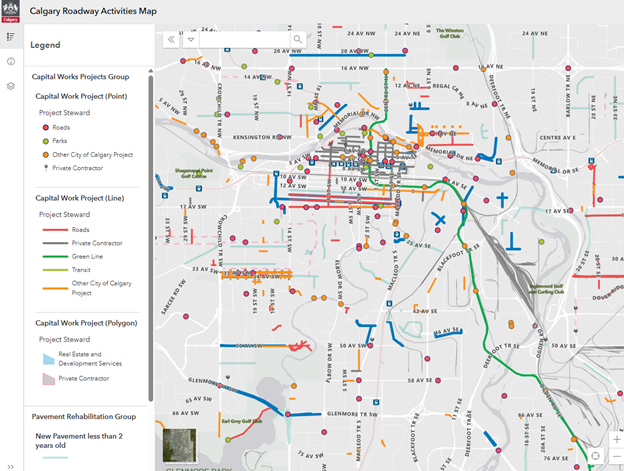
Calgary Roadway Activities Map
The Calgary Roadway Activities Map is a visual representation of road projects, such as paving. Click the link to discover what’s happening on Calgary’s transportation network!
Information for Contractors and Consultants
All road work must comply with Calgary’s Roads Construction Standard Specification.
Frequently Asked Questions (FAQ)
How will I be notified if paving work is scheduled in my neighbourhood?
Paving occurs not only on major routes, but in communities as well. If you live on a street where paving work will happen, project staff will connect with you prior to the start of the project to deliver information detailing the project impacts and provide contact information.
How does The City decide which roads to repave?
The City follows a multi-step process to objectively evaluate pavement quality and condition of Calgary’s road network and identify priorities for each paving season. The paving program is determined based on factors such as budget, upcoming infrastructure work (including utility repairs), and pavement quality.
Learn more about the Paving Programs processes in the road work brochure. All work complies with Calgary’s Roads Construction Standard Specifications.


