Land Use Bylaw maps
The 1P2007 Land Use Maps below show the Land Use District for each parcel of land in The City. These Land Use Districts came into effect June 1, 2008, replacing the 2P80 Land Use Maps, which have been archived and made available at the bottom of this page.
The City of Calgary regulatory flood map shows the floodway, flood fringe and overland flow zones of the Bow and Elbow Rivers and Nose and West Nose Creeks.
For more information on flood mapping and alternative mapping formats, please visit our Flood Story Map.
Land Use Maps
When Land Use Bylaw 1P2007 came into effect on June 1, 2008,, all parcels of land in The City were redesignated to new Land Use Districts. In order to do this, the existing land use for every property was reviewed to determine the most appropriate Land Use District from 1P2007 for it.
The land use analysis and district transition process followed several guiding principles to ensure an equitable and consistent approach. As a general principle, the existing land use designation of a site was changed to the closest matching land use district in the new Land Use Bylaw.
Principles of the Transitioning Process
- To facilitate the goals of the Land Use Bylaw and the purposes of the districts
- To be consistent with existing policy, such as area structure plans, area redevelopment plans or other approved community planning policies
- To facilitate clarity and legibility, so that land use maps are more representative of the development that is on, or allowed on, a parcel
- To be consistent and equitable
- To maintain a parcel's development potential, to the extent possible, recognizing the new Land Use Bylaw will include adjustments to processes and standards
- Where possible to replace existing Direct Control districts with a new districts from the Proposed Land Use Bylaw, where the new districts closely match the regulations of the Direct Control Bylaw.
The Land Use (Zoning) Maps on this site show how the districts in Land Use Bylaw 1P2007 have been applied. They are provided for reference purposes only. Please carefully read the disclaimer at the bottom of each map section on this page.
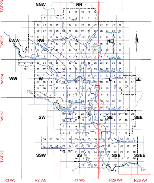
Land Use Bylaw 1P2007 maps
The Land Use Bylaw 1P2007 was adopted by Council and became effective on June 1, 2008. The City of Calgary provides this information in good faith but it provides no warranty, nor accepts any liability arising from any incorrect, incomplete or misleading information or its improper use as changes occur.
Click to expand Land Use Section map or download a PDF
Development Map
To search for a specific address, please visit the Development Map.
After entering an address, note the old and the new land use district. Follow the link to see the rationale that explains the change. Should you require further information, please call 311.
Contact us
Planning Services Centre
Hours: Monday - Friday, 8 a.m. - 4:00 p.m.
Live chat: calgary.ca/livechat
Call: 403-268-5311
Web: Planning Services Centre
Development approvals review team
Find development approvals review team staff to contact about specific applications.
Heritage Guidelines Areas
Amendments to the Land Use Bylaw 1P2007 have been approved to enable implementation of the Heritage Guidelines in identified Heritage Guideline Areas.
These amendments will ensure that all housing types (single detached dwellings, semi-detached dwellings, and rowhouse buildings) that are allowed within Heritage Guideline Areas become Discretionary Uses. The discretionary development permit application review will apply the Heritage Guidelines to ensure the application meets the Heritage Guideline policies.
Heritage Guidelines are included as an amendment to the following Local Area Plans:
- North Hill Communities Local Area Plan, Section 1.3, approved on December 6, 2022.
- Maps: 21C, 22C, 27C, 28C
- Westbrook Communities Local Area Plan, Section 2.6.2 to replace Heritage Guideline placeholder policy with specific Heritage Guidelines, approved on January 14, 2025.
- Maps: 17C, 18C
- Riley Communities Local Area Plan, Section 2.6.2, approved on March 4, 2025
- Maps: 17C, 20C, 21C, 22C
- West Elbow Communities Local Area Plan, Section 2.6.2, approved on May 7, 2025
- Maps: 4C, 8C, 9C, 10C, 17C
The City of Calgary heritage guideline areas maps below show those parcels with heritage assets and where the heritage guidelines apply. Some maps apply to multiple local area plans.
These maps form part of the Land Use Bylaw 1P2007.
The City of Calgary provides this information in good faith but it provides no warranty, nor accepts any liability arising from any incorrect, incomplete or misleading information or its improper use. This information may be updated as changes occur.
Land Use Bylaw 2P80 maps (archived)
This map forms part of Calgary’s previous Land Use Bylaw 2P80, which was replaced by Land Use Bylaw 1P2007 on June 1, 2008. Please refer to the Land Use Bylaw 1P2007 maps above for the most current information.
These Land Use Bylaw maps have been archived for reference purposes only. The City of Calgary provides this information in good faith but it provides no warranty, nor accepts any liability arising from any incorrect, incomplete or misleading information or its improper use as changes occur.