Storm Utilities
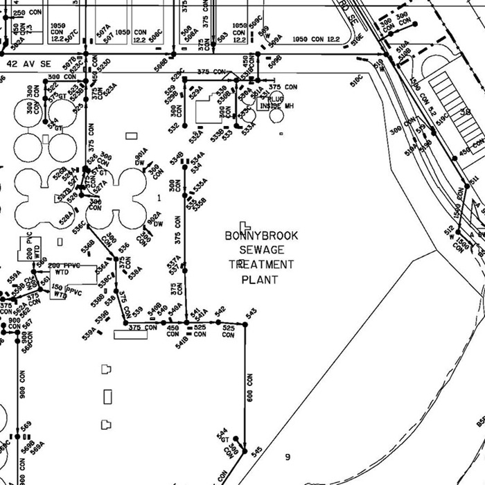
Storm Utility Section Maps show the major components of the Storm Sewer System infrastructure within The City of Calgary. The maps are divided into individual legal sections because of the size of the datasets involved.
The major datasets shown on the maps include storm mains, manholes, culverts, outfalls, catch basins, and commercial services/private areas. The mains shown are located by line assignments referenced from property lines, easements, and utility rights-of-way. The property line information is not included in the maps but can be obtained by purchasing either the Legal Survey Fabric (LSF) or Ownership Parcel Fabric (OPF) map with the corresponding section number.
User(s)
- Developers
- Architects
- First-Call utility locators
- Consulting Engineers
- Builders
Uses
Storm Utility Section Maps are used when larger area overviews of storm sewer data are needed. When more precise detail or z-coordinate information is required, Electronic Block Profile data is the recommended source.
Benefits
- Accurate – Sanitary Utility Section Maps are updated on an ongoing basis and are the priority dataset for displaying new and updated sanitary sewer information.
- Efficient – Immediate download available; licensing process is completed in minutes, not days.
- Cost effective – Obtaining a Sanitary Utility Section Map license saves the cost of developing an original.
- Practical – Sanitary Utility Section Maps are sold by the section.
Additional Specifications
Storm Utility Section Maps are updated when new infrastructure is created or when existing infrastructure is revised or removed. The trigger to update the data is the receipt of p>Default Legend Scale - Min: 0 Max: 500,001
Example of Storm Utilities Section Map