What does rezoning mean?

One of the actions of the Housing Strategy is to propose citywide rezoning to a base residential district, or zone, to allow for a greater variety of housing in all communities across the city.

It will be easier, and legal, to build various types of homes in our communities, and this will increase housing options for everyone.

People with properties that only allow single or semi-detached homes will have more options. 

Proposed (re)developments will still be reviewed in detail to ensure they remain compatible with the surrounding community.

Parks or green spaces will remain the same, even if they are rezoned. 

Existing homes can be replaced with new, single-detached homes.

Single-family homes will remain. The City will support all permitted development forms.

There will still be a development permit process. The landowner will need to apply for (re)development and building permits.

Apartment buildings cannot be built on parcels where single-detached homes are today.

Rezoning and development permits


Rezoning happens when a property owner wishes to develop something besides what is currently allowed under the existing zoning. 

Rezoning will streamline the process that property owners must follow if they want to redevelop on their property, eliminating the need for individual and time-consuming rezoning (saving months!).

Council makes the final decision on whether to approve or refuse a rezoning application after a public hearing. If the rezoning is approved by Council, the applicant can submit a development permit application. City Planners then review the application and all aspects of the individual property. 

Development and Building Permits may still be required depending on the location of the property. Building permits are always required for new homes. It is these two permits that ensure new buildings meet the rules for height, lot coverage, setbacks, and landscaping, and that the houses are built to meet health and safety requirements.

Learn more about the development permit process.

What is being proposed and zoning details


Residential – Grade-Oriented Infill (R-CG)

Residential – Grade-Oriented Infill (R-CG) is a land use district/zone used in the developed areas. It allows for a variety of housing forms. This district has contextual rules that take into account the existing styles of homes around the redevelopment site. 

What are the specific rules in an R-CG district/zone?
 

Rowhouse

Single-detached

Semi-detached

Townhouse

Residential – Low Density Mixed Housing (R-G)

Residential – Low Density Mixed Housing (R-G) is a land use district/zone that allows for a variety of housing forms. R-G parcels are located in areas of a neighbourhood appropriate for a range of low-density housing forms. This district is used in developing (greenfield) areas.

What are the specific rules in an R-G district/zone?
 
  • Height: 12 metres
  • Types of homes allowed: Single-detached, semi-detached, and rowhouse.
  • Density: Each dwelling unit requires a minimum parcel area of 150 m2 (1 unit/0.015ha).
  • Parking: 1 stall per unit (dependent on the type of housing).

Rowhouse

Single-detached

Semi-detached

Housing – Grade Oriented (H-GO) District

Housing Grade Oriented (H-GO) is a district that is appropriate in locations within a community, typically along streets with a focus on accommodating more pedestrians or streets that connect different parts of a community. This district adds the option of higher intensity redevelopment than that of R-CG, but still maintains direct ground level access for all homes.

What are the specific rules in an H-GO district/zone?
 
  • Height: 12 metres
  • Types of homes allowed: New homes are permitted in this district as long as the proposal meets the rules of the Land Use Bylaw.
  • Density: The maximum parcel coverage is 45 - 60%.
  • Parking: 0.5 stalls per unit and suite.

Grade Oriented (H-GO)

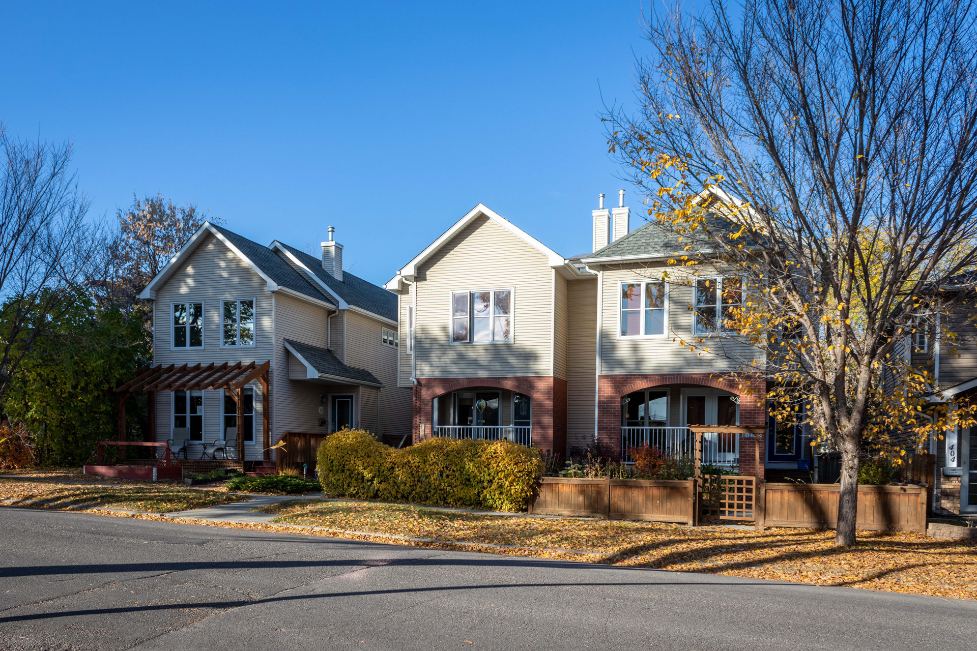
Zoning examples - Calgary communities


Click to expand images.

How will rezoning affect me?


Interactive address map

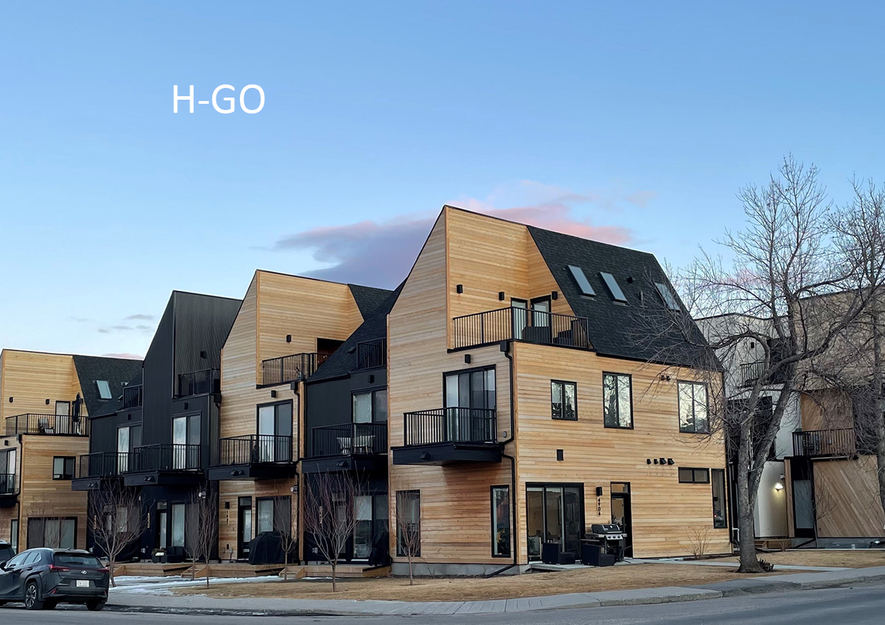
To use the interactive address map, enter your address in the search field. The search results will display your current land use designation (rezoning from) as well as the proposed new designation (rezoning to R-CG, R-G, or H-GO).

Launch the interactive address map

This information has no legal status and cannot be used as an official interpretation of the various bylaws, codes and regulations currently in effect. The City of Calgary accepts no responsibility to persons relying solely on this information. Web pages are updated periodically. ​

undefined/null,undefined/null,undefined/null,undefined/null,undefined/null,undefined/null,undefined/null,undefined/null,undefined/null,undefined/null,undefined/null,undefined/null,undefined/null,undefined/null,undefined/null,undefined/null,undefined/null,undefined/null,undefined/null,undefined/null,undefined/null,undefined/null,undefined/null,undefined/null,undefined/null,undefined/null,undefined/null,undefined/null,undefined/null,undefined/null,undefined/null,undefined/null,undefined/null,undefined/null,undefined/null,undefined/null,undefined/null,undefined/null,undefined/null,undefined/null,undefined/null,undefined/null,undefined/null,undefined/null,undefined/null,undefined/null,undefined/null,undefined/null,undefined/null,undefined/null,undefined/null,undefined/null,undefined/null,undefined/null,undefined/null,undefined/null,undefined/null,undefined/null,undefined/null,undefined/null,undefined/null,undefined/null,undefined/null,undefined/null,undefined/null,undefined/null,undefined/null,undefined/null,undefined/null,undefined/null,undefined/null,undefined/null,undefined/null,undefined/null,undefined/null,undefined/null,undefined/null,undefined/null,undefined/null,undefined/null,undefined/null,undefined/null,undefined/null,undefined/null,undefined/null,undefined/null,undefined/null,undefined/null,undefined/null,undefined/null,undefined/null,undefined/null,undefined/null,undefined/null,undefined/null,undefined/null,undefined/null,undefined/null,undefined/null,undefined/null,undefined/null