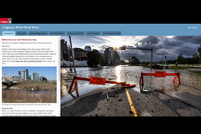
Understand Flooding - Flood maps and river flows
June 2026 update
In May 2025, the Government of Alberta released updated Flood Hazard Area maps for communities across the province, including Calgary, that reflect the latest understanding of flood risk. The maps include a new approach for flood hazard area mapping, dividing the flood hazard area into four categories that reflect the level of risk of overland flooding.
The City recently completed a groundwater study to deepen our understanding of Calgary’s river flood-related groundwater risk. The study mapped groundwater levels during a 1 in 100-year flood event. We are proposing to incorporate this into Calgary’s regulatory flood map as a new Groundwater Flood Fringe. We have also been working to update Calgary’s Land Use Bylaw to reflect updated floodplain mapping and regulations.
Following consideration by the Infrastructure and Planning Committee on April 15, 2026, and Council direction on April 28, 2026, the report has been referred back to Administration for additional engagement with affected communities - particularly those in high hazard flood fringe and groundwater flood fringe areas.
This means the updated maps and proposed bylaw amendments are not being adopted at this time. The project team will use this next phase of work to continue engagement, strengthen shared understanding of flood risk, and refine recommendations before returning to Committee in Q4 2026. We will be conducting additional community engagement in Fall 2026.
The proposed maps can be viewed at the map link on this page. For more information about the proposed bylaw amendments, please visit www.calgary.ca/rivervalleys.
Until Calgary’s Flood Hazard Area maps are finalized and City of Calgary policies and bylaws have been updated, development applications will continue to be assessed under the current Land Use Bylaw. However, we will continue to share the best available flood risk information with development applicants and others to provide advisory comments for further resilience, or to permit relaxations as appropriate, as we have since 2013.
We can’t prevent flooding entirely, but we can be prepared for when it happens. One of the best ways to be flood-ready is to know your flood risk.
Find out if you are at risk for flooding
Learn more about how flooding happens in Calgary, including types of flooding, highest risk seasons, causes and impacts to our city.
Current flood status
Is it flooding?
Stay informed
Calgary Flood Maps and River Flows
View our flood maps and river flow data to see if your property is at risk of flooding.
Our maps portal also includes access to other flood data including:
- Flood hazard maps for land use planning
- Inundation maps for various sized floods
- Hydraulic models and hydrology assessments