Digital Aerial Survey
Overview
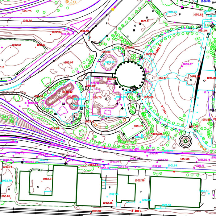
Digital Aerial Survey (DAS) maps illustrate surface features present in an aerial photograph (e.g. buildings, public trees, curbs and gutters, manholes, catch basins, poles, elevation contour lines generated at 0.5 metre intervals.
Derived from aerial photos, DAS products show surface features and topography to within an accuracy of 15 centimetres vertically and horizontally.
User(s)
- Developers
- Architects
- Planners
- Engineers
- Builders
- Environmentalists
- Geospatial Professionals
Uses
- Engineering design
- Emergency services
- Topographic maps
- Road design
- Land development
- Vegetation analysis
- Geotechnical/Hazardous slope mapping
- Base for analytical mapping
- Orienteering
Benefits
- Accurate - +/- 15 cm accuracy makes DAS products suitable for engineering projects.
- Current – City-wide data is updated annually.
- Efficient – Immediate download available; licensing process is completed in minutes, not days.
- Cost effective – Obtaining a DAS map license saves the cost of developing an original map.
- Practical – DAS maps are sold per section base.
Additional Specifications
Digital Aerial Survey data is collected from aerial photography using photogrammetric technology to acquire planimetric and contours updated using LiDAR. The features have a positional accuracy of +/-15 cm in Eastings, Northings, and Elevation. The initial data capture began in 1991. To keep pace with new developments, flight is conducted annually city-wide, during which individual sections are checked and updated. Data is available in AutoCAD DWG, Bentley DGN and Esri SHP file formats.
Example of Digital Aerial Survey Map