Resources and FAQs
Local Area Planning Learn more about Local Area Planning
Resources for teachers and people wanting to learn more about the Local Area Planning process.
Resources
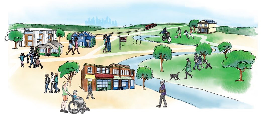
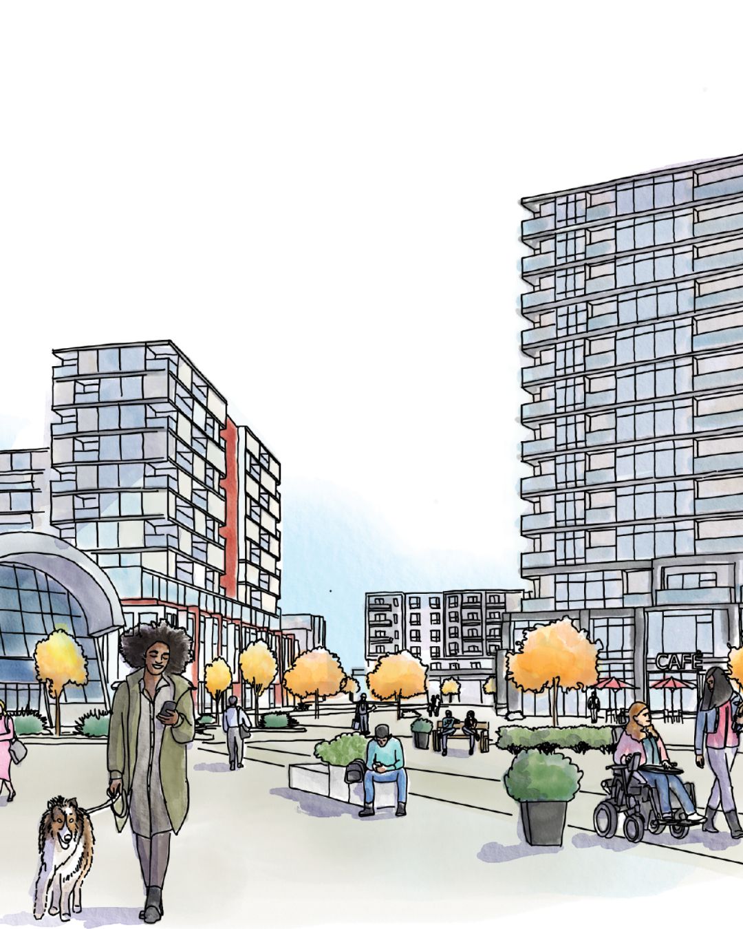
Evolution of communities
Evolution of communities
Evolution of communities
As Calgary’s population grows, and buildings age, people’s needs in their community change. Over time, new businesses open, homes are built or renovated, and parks and pathways are improved to evolve with the people who use them. Local area plans help guide this evolution with input from residents and business owners.
What is a local area plan
What is a local area plan
What is a local area plan?
A local area plan (LAP) sets a long-term vision that balances current and future needs. It guides where housing and businesses fit and identifies future community needs. Shaped by community input, an approved LAP helps council assess development proposals and prioritize local improvements.

Youth voices matter
Youth voices matter
Youth voices matter
Youth participation in local area planning engagement opportunities is critical for developing a plan that meets their future needs.
There are many chances for youth voices to be heard throughout this process.
- Joining the working group
- Teachers hosting a speaker session at school
- Filling out feedback booklets

Get involved
Get involved
Get involved
Getting involved in local area planning engagement opportunities allows you to have a say in the future of your community. You can attend an engagement session, apply to join a working group or provide feedback online. Click here to learn more about community involvement in the local area planning process.

Click here to learn more about community involvement in the local area planning process.
Videos
Want to learn more about local area planning? Check out these videos.
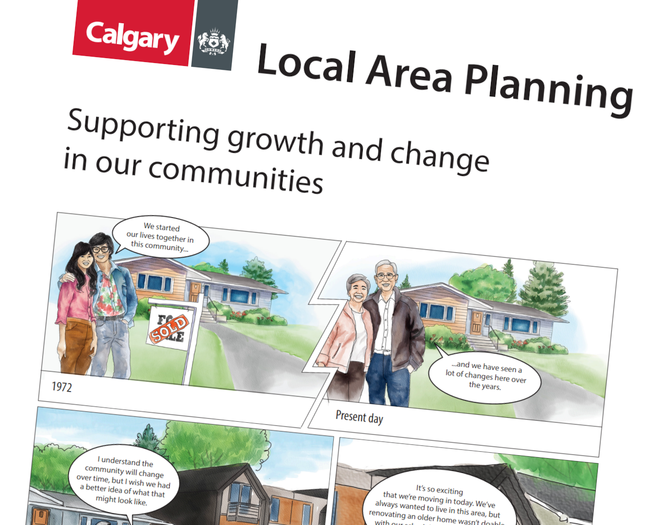
Local Area Planning comic strip
- Local Area Planning Comic Strip – Arabic
- Local Area Planning Comic Strip – Chinese (Simplified)
- Local Area Planning Comic Strip – English
- Local Area Planning Comic Strip – French
- Local Area Planning Comic Strip – Korean
- Local Area Planning Comic Strip – Punjabi
- Local Area Planning Comic Strip – Spanish
- Local Area Planning Comic Strip – Urdu
- Local Area Planning Comic Strip – Vietnamese
Other resources
Learn more and get involved. Get Involved in Shaping Our City and Communities
Land is not rezoned if/when a local area plan is approved. If/when there is interest in rezoning land, it goes through a separate review and decision-making process. Learn more about this process below. Land Use Rezoning Illustration
Maps - building types and size
There are two maps in a local area plan that show where buildings should go based on their use (urban form) and their size (building scale).
Map 1: Urban Form Map
The Urban Form Map shows types of buildings and what they should be used for. These can include primarily commercial/business areas, primarily residential areas and parks and open space.
- Detail the purpose and general function of different parts of the communities.
- Describe the mixture of different building types.
- Include supporting site and building design policies.
Map 2: Building Scale Map
The Building Scale Map shows the maximum height and size buildings can be in a specific area. Scale categories outline building heights and other design considerations such as step backs (where higher floors are set back from lower floors).
- Set the maximum potential height (in storeys) of buildings.
- Apply to the Neighbourhood and Vehicle - Oriented Commercial Categories only (e.g. Parks, Civic and Recreation and Industrial categories do not include an associated scale).
Learn about the different urban forms and building scales and what each colour represents. Toggle to the left/right to view each map. For discussion purposes only.
Map 1: Urban Form Map
Map 2: Building Scale Map
Download the Urban Form and Building Scale Overview.
Frequently asked questions
What is a local area plan?
A local area plan envisions how an area might evolve over the next 30 years. It identifies suitable locations for future development and provides clear guidance for new projects, investments and local improvements.
If the local area plan is approved by Council, it becomes statutory policy (adopted as an area redevelopment plan). Although it does not alter existing zoning or allocate budget, it does inform decisions when proposals for land use changes, new developments, or local improvements are brought forward and considered.
How does a local area plan fit within The City of Calgary’s planning framework?
‘Local area plan’ is a term that The City of Calgary uses when referring to planning policy that guides growth in a specific area of the city.
Under the Municipal Government Act (MGA), there are two types of local area plans:
- In new, developing areas, the plan is called an area structure plan (ASP).
- In older, established communities, the plan is called an area redevelopment plan (ARP).
These plans follow rules set by the MGA, which empowers municipalities to shape their communities. It regulates how municipalities are funded and how they should govern and plan for growth. Both area structure plans and area redevelopment plans are approved by Council.
What happens to existing Council-approved area redevelopment plans (ARPs) when a new local area plan is created?
When a new local area plan is approved by Council, it is adopted as a statutory area redevelopment plan (ARP) and at the same time, any existing ARPs or other non-statutory plans within that area are repealed. Only one ARP can be in place for an area at a time.
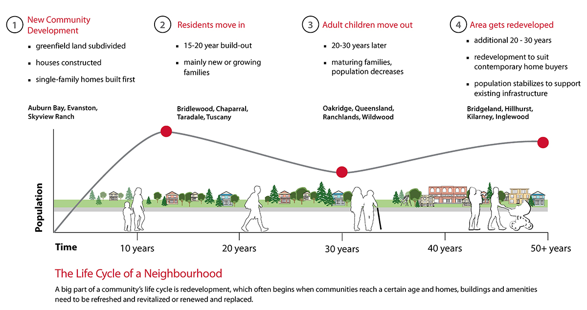
Why are local area plans needed?
Local area plans provide guidance and direction as communities, infrastructure and public spaces age and reach their natural redevelopment lifecycle stage.
Without a guiding plan, each proposal and local improvement project can feel unexpected or disconnected. A local area plan encapsulates a future vision for the area by providing development direction that residents, landowners, builders/developers, City Planners, and Councillors can refer to. This guidance is useful as new development ideas are proposed for the area.
Citywide, we need to consider where and how growth and redevelopment should happen.
We need to consider:
- Changing housing needs and preferences
- Sustainability and urban footprint of our city
- Balancing costs of new and maintaining existing infrastructure, amenities, and facilities to support both new and established communities.
- Balancing population across both new and established communities to support local schools, facilities, and businesses.
The City is responsible for managing growth and development across Calgary and looks at how and where growth should happen. Growth and development are encouraged in key areas. There is a city-wide plan for growth to be distributed between developed and new communities. Learn more about Calgary’s Municipal Development Plan.
How is a local area plan created?
A local area plan takes two to three years to create and it is refined through five phases with three engagement phases.
Through the local area planning process, we work together to:
- Create and refine the future vision and core values.
- Explore and refine maps that identify suitable locations for different types of development.
- Identify community improvement priorities and projects.
What can a local area plan impact?
A local area plan can:
- Incorporate and balance a broad range of inputs—including City policies, participant input, context and trends, equity and professional expertise.
- Set a long-term vision for how an area should grow and change over time.
- Identify suitable locations for different types of development such as housing, mixed-use, commercial, etc.
- Provide local policy direction to support high-quality, context-sensitive development.
- Highlight future improvements to public spaces, mobility connections, parks and community amenities that are needed and/or desired in the area.
- Guide future land use and investment decisions by having a consistent framework to evaluate proposals.
- Be updated. It is a statutory document but also a living, dynamic document that is meant to be updated/amended as local conditions and circumstances change.
Why are communities grouped together?
When looking at the best way to create and update local area plans on an ongoing basis, creating local area plans for each community individually is not sustainable.
Shared amenities like local businesses, transit stations, recreation facilities and schools connect communities together while physical boundaries like major roads, rivers and large natural areas naturally separate us. Our daily experiences are not confined to our immediate community. For example, you might visit a neighbouring community to buy groceries or take yoga classes. You could also travel through multiple communities walking your dog, to get to work, or dine at a restaurant.
Grouping communities by boundaries and shared amenities enables collective planning and discussion. This is the basis behind the concept of The City's local area plans. Having fewer local area plans across Calgary also allows us to better monitor and update local area plans over time.
Local area planning has the following benefits:
- Creates stronger linkages between communities, key amenities and infrastructure.
- Allows for better identification of common issues, opportunities and solutions.
- Facilitates holistic discussions on new growth across larger areas.
- Includes a broader citizen and partner perspective in each plan.
- Allows for more effective engagement and plan development.
- Fewer plans allow for more frequent and consistent updates to address current conditions.
How are local area plan boundaries determined?
Local plan areas use major roads (such as Crowchild Trail, Deerfoot Trail, Anderson Trail, McKnight Boulevard, Shaganappi Trail) and geographic features (rivers, major parks such as Nose Hill, Confederation or Fish Creek parks) as they create more physical boundaries to define city regions. These features are easily identifiable on a map and shape our daily lives. 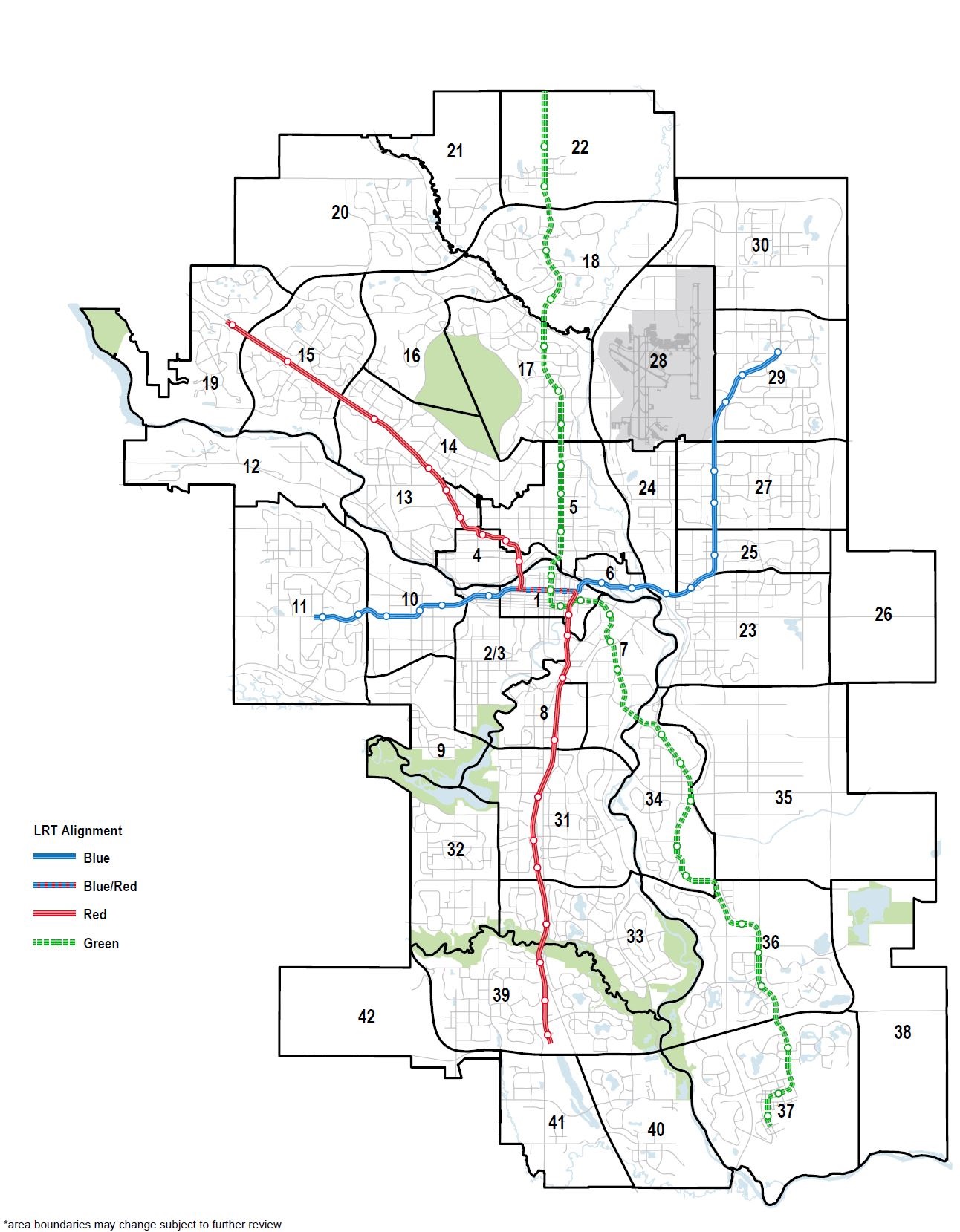
View larger map
Does being in the same local area plan mean that communities will be treated the same in these areas?
No. Each community has unique characteristics. Geography, infrastructure requirements, mobility networks, community layout, history and market will continue to shape each community’s path and policy in the local area plan. The local area planning processes considers these factors as the plan is developed.
Can local area plans be amended?
Local area plans are meant to be living documents which can be amended and updated over time. This allows them to adapt as the community evolves and conditions change.
City Council is the decision maker for all amendments to a local area plan.
We have committed to not support development applications that would require an amendment to a local area plan that would increase density for the first five years after they are approved. We spend significant time working with communities to develop a local area plan and want to build trust and respect that process.
When a local area plan is approved, we have spent significant time working with communities to build a vision for the area and don't want to lose trust by supporting development that doesn't align with that vision. There are small exceptions to that, which could include unanticipated significant infrastructure investment, Council direction or amendments that update a comprehensive planning site with specific policy.
How is participant feedback used in the creation of a local area plan?
- Collect – all feedback from each phase is gathered – online input, mailed forms and comments from in-person and virtual sessions.
- Analyze – the project team reviews everything and groups feedback into key themes and recurring ideas.
- Report what we heard – a What We Heard Report is created for each phase, summarizing engagement activities, verbatim comments and the main themes raised.
- Review and consider – the project team reviews and considers participant feedback and other key considerations (including City policies, context and trends, equity and professional expertise).
- Refine the plan – plan content and concepts are updated based on participant input and all other considerations.
- Report back on what we did – a What We Did Report and Engagement Summary explain what changed, what didn’t, and why—including the key updates made based on feedback.
The goal of public engagement isn’t to reach consensus or make everyone happy. Public engagement considers input from those affected before making decisions. Public input is an important part of local area planning, but is one of many areas of consideration. Other areas include: City policies, professional expertise, context, trends, and equity.