Riparian areas in Calgary
Riparian areas in Calgary
Preserving and protecting our river areas.
Calgarians care about our river areas – 83 per cent say these spaces are important to them personally. Whether you live, work or play in Calgary, you depend on healthy river areas to support clean drinking water, resilience to flood and drought, plant and animal life, recreational opportunities and experiences of nature in the city.
Calgarians also care that The City of Calgary has a plan to preserve and protect our river areas. The 2013 Riparian Strategy outlined a high-level framework with a vision, principles and strategies for protecting our river areas. This was followed up with a more detailed plan called the Riparian Action Program (RAP). Check out the Healthy Rivers Story Map to learn all about Calgary’s watersheds, rivers, riparian areas and restoration and management actions. Related events and volunteer activities are also listed here.
The RAP plan is used by City planners, engineers, practitioners and watershed stewards, as well as the community, for direction and ideas on how to protect and restore riparian landscapes in Calgary. It is intended to help practitioners and Calgarians actively engage and align their work across our watersheds.
On this page, you'll find information on:
Maps
The Riparian Areas Mapping Project Report (2013), provides background technical information on the process for mapping riparian areas along major rivers and streams in Calgary.
These techniques were used to produce the following map booklets:
- Bow River riparian area maps
- Elbow River riparian area maps
- Nose Creek and West Nose Creek riparian area maps
- Twelve Mile Coulee, Coach Creek, Confederation Creek, Forest Lawn Creek, Radio Tower Creek and Pine Creek riparian area maps
The Open Data Catalogue also includes:
- Spatial data on riparian area locations
- The City's Environmental Reserve Setback areas
- Non permanent streams (ephemeral and intermittent streams) maps
Resources
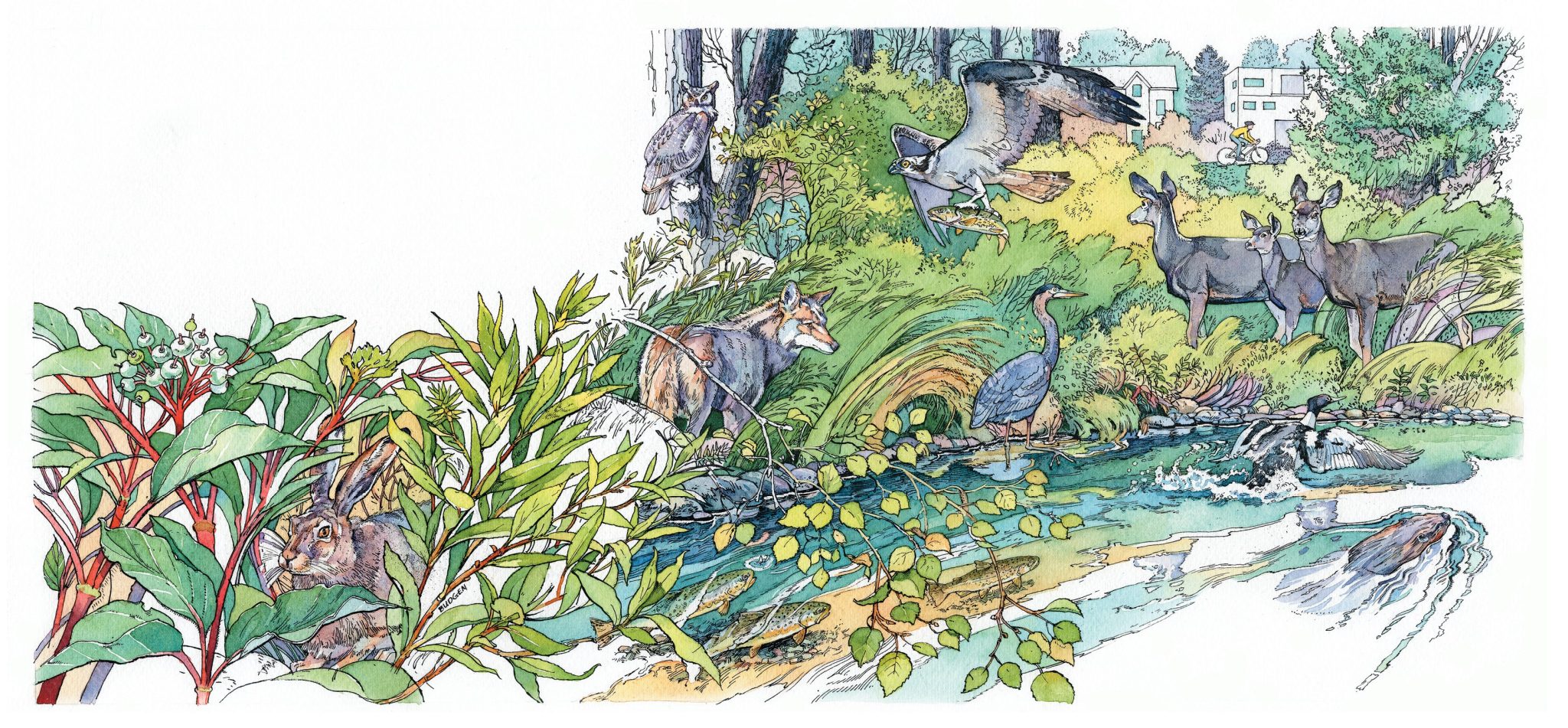
Activity book
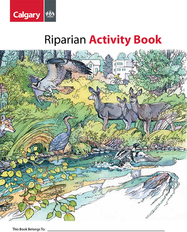
Take a staycation this summer and discover your local rivers and creeks. Download the YYCRivers Activity Booklet to help guide your adventure.
Healthy rivers
Learn more about Calgary's rivers, riparian areas and watershed protection through the Health Rivers Map.
Riparian Action Program (RAP) report
A detailed plan on how we plan to preserve and protect our river areas.
Guidelines and tools for project managers

The following Riparian Decision Matrix for River Engineering Projects is intended as a decision support tool for City of Calgary projects involving bank stabilization, restoration and/or river engineering. Project engineers and consultants involved with these projects use this matrix in project management, design, administration and construction to ensure bioengineering practices are applied to the maximum extent possible within Calgary.
- Riparian Management Category Maps provide a cohesive geospatial "vision" for the protection, management and use of riparian areas in Calgary, and are related to the Riparian Decision Matrix for River Engineering Projects (see page 49 of the Riparian Action Program).
- Design Guidelines for Erosion and Flood Control for Streambank and Riparian Stability
| Riparian Management Zone | Hard engineering | Bioengineering/soft engineering | Example sites* |
|---|---|---|---|
|
Riparian Management Zone:
Flood and erosion control zones |
Hard engineering:
Permitted As necessary |
Bioengineering/soft engineering:
Preferred |
Example sites*:
Memorial + 19 St. Alyth Yard Bridge MacDonald Bridge Elbow Rail Bridge |
|
Riparian Management Zone:
Conservation zones |
Hard engineering:
Prohibited |
Bioengineering/soft engineering:
Required |
Example sites*:
Discovery Ridge |
|
Riparian Management Zone:
Restoration zones |
Hard engineering:
Discretionary |
Bioengineering/soft engineering:
Preferred |
Example sites*:
Douglasdale |
|
Riparian Management Zone:
Recreation zones |
Hard engineering:
Discretionary |
Bioengineering/soft engineering:
Required |
Example sites*:
Lindsay Park |
*Contact 311 for more information on example sites and locations.
Policy
- Calgary’s Source Water Protection Policy ensures we integrate and embed watershed protection into land use decisions within Calgary and the broader region. The Riparian Action Program is one of the foundational plans supporting this policy.
- Calgary's Municipal Development Plan includes a guiding mandate to conserve and restore the natural environment, including riparian green infrastructure.
- Our BiodiverCity is Calgary’s 10-year strategic plan for fostering resilient, biologically diverse open spaces and neighbourhoods.
- Calgary’s Environmental Reserve (ER) Setback Policy and Guidelines are based on the Municipal Government Act and are variable widths based on a number of factors, including waterbody type, slope, vegetation cover and local groundwater influence.
- Calgary's Wetland Conservation Policy provides procedures for the protection of our priority urban wetlands.
Monitoring our performance
Riparian health
To assess riparian health, we use the Riparian Health Inventory (RHI) methodology - developed by the Alberta Riparian Habitat Management Society (Cows and Fish). For stream and small river systems, RHI scores are derived from an evaluation of 11 key vegetation and soil/hydrology health parameters assessed in the field. For large rivers like the Bow River, RHI scores are based on an evaluation of eight of these parameters in addition to seven others related to tree cover and hydrology (see figure below). The parameters assessed are largely based on visual estimates made in the field by trained observers, supplemented by measurements. Riparian health scores are expressed both as a percentage and a rating of Healthy, Healthy with problems or Unhealthy.
| Health category | Score range | Description |
|---|---|---|
|
Health category:
Healthy |
Score range:
80-100% |
Description:
Little to no impairment to any riparian functions |
|
Health category:
Healthy, but with problems |
Score range:
60-79% |
Description:
Some impairment to riparian functions due to human or natural causes |
|
Health category:
Unhealthy |
Score range:
>60% |
Description:
Severe impairment to riparian functions due to human or natural causes |
| Riparian health parameter assessed | Sub parameter assessed | Streams and small rivers | Large rivers |
|---|---|---|---|
|
Riparian health parameter assessed:
Vegetation |
Sub parameter assessed:
Vegetation cover |
Streams and small rivers:
Yes |
Large rivers:
|
|
Riparian health parameter assessed:
|
Sub parameter assessed:
Cottonwood and poplar regeneration |
Streams and small rivers:
|
Large rivers:
Yes |
|
Riparian health parameter assessed:
|
Sub parameter assessed:
Regeneration of other tree species |
Streams and small rivers:
|
Large rivers:
Yes |
|
Riparian health parameter assessed:
|
Sub parameter assessed:
Preferred shrub regeneration |
Streams and small rivers:
|
Large rivers:
Yes |
|
Riparian health parameter assessed:
|
Sub parameter assessed:
Preferred tree/shrub regeneration |
Streams and small rivers:
Yes |
Large rivers:
|
|
Riparian health parameter assessed:
|
Sub parameter assessed:
Preferred tree/shrub utilisation and woody vegetation removal by other than browsing |
Streams and small rivers:
Yes |
Large rivers:
Yes |
|
Riparian health parameter assessed:
|
Sub parameter assessed:
Dead/decadent woody material |
Streams and small rivers:
Yes |
Large rivers:
Yes |
|
Riparian health parameter assessed:
|
Sub parameter assessed:
Total canopy cover of woody plants |
Streams and small rivers:
|
Large rivers:
Yes |
|
Riparian health parameter assessed:
|
Sub parameter assessed:
Invasive plants |
Streams and small rivers:
Yes |
Large rivers:
Yes |
|
Riparian health parameter assessed:
|
Sub parameter assessed:
Disturbance plants |
Streams and small rivers:
Yes |
Large rivers:
Yes |
|
Riparian health parameter assessed:
Physical |
Sub parameter assessed:
Root mass protection |
Streams and small rivers:
Yes |
Large rivers:
Yes |
|
Riparian health parameter assessed:
|
Sub parameter assessed:
Human-caused alteration to banks |
Streams and small rivers:
Yes |
Large rivers:
Yes |
|
Riparian health parameter assessed:
|
Sub parameter assessed:
Human-caused bare ground |
Streams and small rivers:
Yes |
Large rivers:
Yes |
|
Riparian health parameter assessed:
|
Sub parameter assessed:
Human-caused alteration to rest of site |
Streams and small rivers:
Yes |
Large rivers:
Yes |
|
Riparian health parameter assessed:
|
Sub parameter assessed:
Floodplain accessibility |
Streams and small rivers:
|
Large rivers:
Yes |
|
Riparian health parameter assessed:
|
Sub parameter assessed:
Channel incisement |
Streams and small rivers:
Yes |
Large rivers:
|
|
Riparian health parameter assessed:
|
Sub parameter assessed:
Removal or addition of water from/to river system |
Streams and small rivers:
|
Large rivers:
Yes |
|
Riparian health parameter assessed:
|
Sub parameter assessed:
Control of flood peak and timing by upstream dam |
Streams and small rivers:
|
Large rivers:
Yes |
2026 riparian health target
We are committed to conserving and improving the ecological health of riparian areas in Calgary as outlined in the Riparian Strategy and Riparian Action Program. The program sets a 2026 riparian health target of a city-wide average riparian health score of 72 per cent.
Measuring riparian health over time
In 2017, we initiated a five-year Riparian Monitoring Program (RMP) to better understand long-term riparian health trends. A key objective of the RMP is to monitor progress toward meeting the program target of 72 per cent. This entails ongoing monitoring of benchmark RHI monitoring sites established since 2007 and conducting new RHIs in “gap” areas not previously assessed. Another key objective is to evaluate the effectiveness of bioengineering and riparian planting practices. RMP Phase 1 was completed in 2018 and consisted of the development of the Monitoring Plan. Phase 2 was undertaken from 2018 to 2022 as part of a five-year program to implement the monitoring plan.
RMP Phase 2 Final Program Report below summarizes key results, successes, areas for improvement and recommendations documented during Phase 2 of the RMP. Contact norma.posada@calgary.ca for additional information.
2024 city-wide and waterbody riparian health score
101 sites; 84 km of bank length; 590.5 ha
From 2014 onward, and after the completion of Phase 2 of the RMP in 2022, the riparian health trend monitoring program expanded from 58 to 101 sites, resulting in an average city-wide riparian health score of 69 per cent. The baseline is 61 per cent based on the original 58 sites. The figure below shows the riparian health score at the city-wide level and by waterbody after the completion of the RMP Phase 2. The monitoring program expanded to 103 sites in 2024. The average city-wide riparian health score declined slightly from 69 to 68.4 per cent in 2024.
The Bioengineering Demonstration and Education Project
In 2013, Alberta Environment and Parks (AEP) and The City partnered to undertake the Bioengineering Demonstration and Education Project (BDEP) through AEP’s Southern Alberta Fisheries Habitat Enhancement and Sustainability (FISHES) Program. The BDEP includes 680 m of the right bank of the Bow River between Pearce Estate Park and the Inglewood Bird Sanctuary in Inglewood.
After the BDEP was built in 2019, we began monitoring the site as part of the Riparian Monitoring Program. Several bioengineering techniques are currently being monitored as part of a 10-year monitoring plan to show how bioengineering techniques used in the project are improving fish habitat, wildlife habitat, riparian health and structural integrity.
The BDEP is providing valuable data to support the use of bioengineering techniques as effective and ecologically valuable alternatives to hard engineering practices for bank erosion protection.